FOR AUTHORS
Search
Search Results
##search.searchResults.foundPlural##
-
Spatial accessibility to basic public health services in South Sudan
8113PDF: 2360APPENDIX: 5621HTML: 1117 -
Geographical accessibility to healthcare by point-of–interest data from online maps: a comparative study
933PDF: 214Supplementary Materials: 57HTML: 9 -
Flexible scan statistic with a restricted likelihood ratio for optimized COVID-19 surveillance
604PDF: 178Supplementary Materials: 80HTML: 22 -
Assessing the effects of air temperature and rainfall on malaria incidence: an epidemiological study across Rwanda and Uganda
5928PDF: 2103Appendix: 547HTML: 3240Appendix: 197 -
Making the most of spatial information in health: a tutorial in Bayesian disease mapping for areal data
6802PDF: 2294APPENDIX: 1084HTML: 5109 -
A dynamic, climate-driven model of Rift Valley fever
4239PDF: 1639Appendix: 488HTML: 1576 -
To what extent does climate explain variations in reported malaria cases in early 20th century Uganda?
3844PDF: 1116Appendix: 466HTML: 1211 -
Optimizing allocation of colorectal cancer screening hospitals in Shanghai: a geospatial analysis
1607PDF: 812Supplementary Materials: 85HTML: 20 -
Spatial clusters of human and livestock anthrax define high-risk areas requiring intervention in Lao Cai Province, Vietnam 1991-2022
2013PDF: 589Supplementary Materials: 95HTML: 52 -
Spatial-temporal risk factors in the occurrence of rabies in Mexico
3804PDF: 1036HTML: 764 -
Spatial variations of COVID-19 risk by age in Toronto, Canada
784PDF: 318Appendix: 135HTML: 116 -
Reducing bias in risk indices for COVID-19
2657PDF: 283Appendix: 335HTML: 30 -
Investigating local variation in disease rates within high-rate regions identified using smoothing
442PDF: 287Supplementary Materials: 65HTML: 11 -
Integrating agent-based disease, mobility and wastewater models for the study of the spread of communicable diseases
1858PDF: 433Supplementary Materials: 316HTML: 202 -
Spatiotemporal transmission and socio-climatic factors related to paediatric tuberculosis in north-western Ethiopia
3372PDF: 1129APPENDIX: 362HTML: 839 -
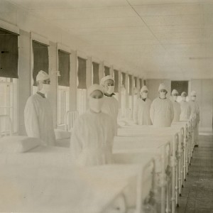
Spatial comparison of London’s three waves of Spanish flu
1122PDF: 482HTML: 318 -
Spatial and spatio-temporal clusters of lung cancer incidence by stage of disease in Michigan, United States 1985-2018
6252PDF: 856Supplementary Materials: 93HTML: 82 -
The food environment and adult obesity in US metropolitan areas
5775PDF: 2558HTML: 1204 -
Assessing spatial patterns of HIV prevalence and interventions in semi-urban settings in South Africa. Implications for spatially targeted interventions
1909PDF: 465Supplementary 1: 87Supplementary 2: 231HTML: 145 -
Intra-urban differences underlying leprosy spatial distribution in central Brazil: geospatial techniques as potential tools for surveillance
1122PDF: 520Supplementary Materials: 56HTML: 11 -
Sandwich mapping of schistosomiasis risk in Anhui Province, China
2847PDF: 1142HTML: 1072 -
Spatiality in small area estimation: A new structure with a simulation study
1032PDF: 461Supplementary materials: 127HTML: 11 -
Identifying counties vulnerable to diabetes from obesity prevalence in the United States: a spatiotemporal analysis
2490PDF: 1147APPENDIX: 389HTML: 1128


