











































FOR AUTHORS
Search
Search Results
##search.searchResults.foundPlural##
-

-

Geographical accessibility to healthcare by point-of–interest data from online maps: a comparative study
2061PDF: 646Supplementary Materials: 183HTML: 39 -

Factors associated with the spatial distribution of leprosy: a systematic review of the published literature
1123PDF: 509Supplementary materials: 98HTML: 20 -

A topological multilayer model of the human body
3341PDF: 1328HTML: 1590 -

Mapping livestock systems, bovine and caprine diseases in Mayo-Kebbi Ouest Province, Chad
3970PDF: 1469Supplementary Materials: 637HTML: 206 -

Balancing geo-privacy and spatial patterns in epidemiological studies
4192PDF: 1361APPENDIX: 576HTML: 964 -

Making the most of spatial information in health: a tutorial in Bayesian disease mapping for areal data
7577PDF: 2616APPENDIX: 1207HTML: 5512 -

Assessing the effects of air temperature and rainfall on malaria incidence: an epidemiological study across Rwanda and Uganda
6649PDF: 2462Appendix: 664HTML: 3365Appendix: 279 -

Haemodialysis services in the northeastern region of Iran
4499PDF: 1344HTML: 915 -

Venomous snakebite risk and its implications in Zacatecas State, Mexico 2007-2017
1039PDF: 423Supplementary materials: 131HTML: 12 -
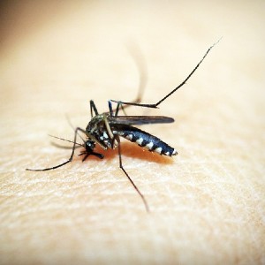
Prediction of dengue cases using the attention-based long short-term memory (LSTM) approach
3744PDF: 1592Supplementary Materials: 219HTML: 137 -

Reduction of latency in geospatial analysis of air quality: a classical modelling approach inspired by quantum principles
185PDF: 62Supplementary Materials: 31HTML: 3 -

Integrating agent-based disease, mobility and wastewater models for the study of the spread of communicable diseases
2618PDF: 747Supplementary Materials: 416HTML: 224 -

Sentiment analysis using a lexicon-based approach in Lisbon, Portugal
1422PDF: 666Supplementary Materials: 229HTML: 85 -

Identifying counties vulnerable to diabetes from obesity prevalence in the United States: a spatiotemporal analysis
2891PDF: 1389APPENDIX: 506HTML: 1190 -

Access to the COVID-19 services during the pandemic - a scoping review
2654PDF: 891Appendix: 353HTML: 129 -

Spatial analysis of antimicrobial resistance in the environment. A systematic review
3410PDF: 1259Supplementary Materials: 343HTML: 78 -

Zoning the territory of the Republic of Kazakhstan as to the risk of rabies among various categories of animals
2947PDF: 1497APPENDIX: 753HTML: 1512 -

Spatial dispersal of Aedes albopictus mosquitoes captured by the modified sticky ovitrap in Selangor, Malaysia
2184PDF: 976Annex I-VI: 194HTML: 80 -
Spatial-temporal risk factors in the occurrence of rabies in Mexico
4936PDF: 1538HTML: 1148 -

Spatial inequalities in cancer with special reference to lung cancer across Europe and their implications for environmental health policy
814PDF: 408Supplementary materials: 50HTML: 17 -

An analysis of the process and results of manual geocode correction
2550PDF: 1083HTML: 990 -

Spatial access disparities to primary health care in rural and remote Australia
24229PDF: 10074HTML: 2353 -

Does the Geohealth domain require a body of knowledge?
2057PDF: 734HTML: 37 -

Intra-urban differences underlying leprosy spatial distribution in central Brazil: geospatial techniques as potential tools for surveillance
1674PDF: 772Supplementary Materials: 148HTML: 25 -

Where to place emergency ambulance vehicles: use of a capacitated maximum covering location model with real call data
3782PDF: 1300Supplementary Materials: 969HTML: 192 -

Assessing spatial patterns of HIV prevalence and interventions in semi-urban settings in South Africa. Implications for spatially targeted interventions
2519PDF: 619Supplementary 1: 185Supplementary 2: 398HTML: 181