



































































FOR AUTHORS
Search
Search Results
##search.searchResults.foundPlural##
-

Geographical accessibility to healthcare by point-of–interest data from online maps: a comparative study
909PDF: 210Supplementary Materials: 57HTML: 9 -

Spatial accessibility to basic public health services in South Sudan
8104PDF: 2353APPENDIX: 5596HTML: 1117 -

To what extent does climate explain variations in reported malaria cases in early 20th century Uganda?
3840PDF: 1112Appendix: 464HTML: 1211 -

Spatial autocorrelation and heterogenicity of demographic and healthcare factors in the five waves of COVID-19 epidemic in Thailand
1147PDF: 645Supplementary Materials: 89HTML: 22 -

Spread of Ebola virus disease based on the density of roads in West Africa
2270PDF: 694APPENDIX: 458HTML: 1193 -

A dynamic, climate-driven model of Rift Valley fever
4236PDF: 1638Appendix: 487HTML: 1576 -
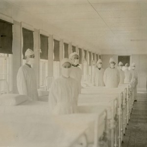
Spatial comparison of London’s three waves of Spanish flu
1118PDF: 477HTML: 314 -

Assessing the effects of air temperature and rainfall on malaria incidence: an epidemiological study across Rwanda and Uganda
5927PDF: 2097Appendix: 546HTML: 3239Appendix: 197 -
Spatial-temporal risk factors in the occurrence of rabies in Mexico
3791PDF: 1028HTML: 758 -

Spatial variations of COVID-19 risk by age in Toronto, Canada
781PDF: 316Appendix: 133HTML: 116 -

Spatial air pollution modelling for a West-African town
3490PDF: 1403SUPPL. MATERIAL: 395HTML: 1078 -

Investigating local variation in disease rates within high-rate regions identified using smoothing
440PDF: 283Supplementary Materials: 64HTML: 11 -

Integrating agent-based disease, mobility and wastewater models for the study of the spread of communicable diseases
1829PDF: 430Supplementary Materials: 311HTML: 202 -

Spatiotemporal transmission and socio-climatic factors related to paediatric tuberculosis in north-western Ethiopia
3370PDF: 1125APPENDIX: 360HTML: 839 -

Association of socioeconomic indicators with COVID-19 mortality in Brazil: a population-based ecological study
1612PDF: 677Supplementary Materials: 67HTML: 33 -

Monitoring techniques in the capture and adoption of dogs and cats
3908PDF: 1618HTML: 1465 -

Reducing bias in risk indices for COVID-19
2653PDF: 280Appendix: 333HTML: 30 -

Spatial association between the incidence rate of COVID-19 and poverty in the São Paulo municipality, Brazil
7078PDF: 1285Appendix: 110HTML: 22 -

Spatial clustering of colorectal cancer in Malaysia
1305PDF: 565HTML: 6 -

Spatial dispersal of Aedes albopictus mosquitoes captured by the modified sticky ovitrap in Selangor, Malaysia
1468PDF: 620Annex I-VI: 103HTML: 58 -

Spatial association of socioeconomic and health service factors with antibiotic self-medication in Thailand
2652PDF: 796Supplementary Materials: 512HTML: 236 -

Spatial pattern evolution of Aedes aegypti breeding sites in an Argentinean city without a dengue vector control programme
3661PDF: 1267APPENDIX: 478HTML: 1533 -

Habitat suitability map of Ixodes ricinus tick in France using multi-criteria analysis
5782PDF: 2174Appendix: 288HTML: 232



