




















































FOR AUTHORS
Search
Search Results
##search.searchResults.foundPlural##
-

Socioeconomic determinants of pandemics: a spatial methodological approach with evidence from COVID-19 in Nice, France
943PDF: 423Supplementary materials: 107HTML: 29 -

Spatial inequalities in cancer with special reference to lung cancer across Europe and their implications for environmental health policy
833PDF: 436Supplementary materials: 53HTML: 18 -

Moran’s I and Geary’s C: investigation of the effects of spatial weight matrices for assessing the distribution of infectious diseases
2704PDF: 960Supplementary materials: 241HTML: 122 -

Intra-urban differences underlying leprosy spatial distribution in central Brazil: geospatial techniques as potential tools for surveillance
1694PDF: 783Supplementary Materials: 149HTML: 26 -

Spatial dispersal of Aedes albopictus mosquitoes captured by the modified sticky ovitrap in Selangor, Malaysia
2208PDF: 993Annex I-VI: 200HTML: 81 -

Optimizing mobile mammography deployment in Oklahoma 2024: a two-step floating catchment area approach
465PDF: 327Supplementary materials: 61HTML: 8 -

Factors associated with the spatial distribution of leprosy: a systematic review of the published literature
1150PDF: 534Supplementary materials: 104HTML: 25 -

Global spreading of Omicron variant of COVID-19
2208PDF: 989HTML: 58 -

Promoting sustainable health equity: accessibility analysis and optimization of tertiary hospital networks in China’s metropolitan areas
979PDF: 792Supplementary materials: 112HTML: 29 -

Access to the COVID-19 services during the pandemic - a scoping review
2682PDF: 911Appendix: 367HTML: 132 -

Sandwich mapping of schistosomiasis risk in Anhui Province, China
3321PDF: 1325HTML: 1096 -

Spatial accessibility to basic public health services in South Sudan
9504PDF: 3027APPENDIX: 7625HTML: 1179 -

Spatial pattern evolution of Aedes aegypti breeding sites in an Argentinean city without a dengue vector control programme
4342PDF: 1731APPENDIX: 588HTML: 1545 -
Measuring geographic access to emergency obstetric care: a comparison of travel time estimates modelled using Google Maps Directions API and AccessMod in three Nigerian conurbations
3435PDF: 1114Supplementary Materials: 189HTML: 256 -
Geospatial tools and data for health service delivery: opportunities and challenges across the disaster management cycle
6663PDF: 927Supplementary Materials: 305HTML: 128 -

Diagnostic approaches to malaria in Zambia, 2009-2014
3790PDF: 1528HTML: 1177 -

Snakebite epidemiology in the State of Mexico, Mexico 2003-2024
1067PDF: 414Supplementary Materials: 212HTML: 37 -

A dynamic, climate-driven model of Rift Valley fever
5002PDF: 2193Appendix: 613HTML: 1602 -
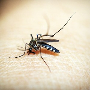
Prediction of dengue cases using the attention-based long short-term memory (LSTM) approach
3793PDF: 1622Supplementary Materials: 222HTML: 144 -

Habitat suitability map of Ixodes ricinus tick in France using multi-criteria analysis
11200PDF: 2695Appendix: 423HTML: 409 -

Sentiment analysis using a lexicon-based approach in Lisbon, Portugal
1438PDF: 681Supplementary Materials: 236HTML: 86 -

Venomous snakebite risk and its implications in Zacatecas State, Mexico 2007-2017
1056PDF: 438Supplementary materials: 149HTML: 12 -

On the geographic access to healthcare, beyond proximity
2837PDF: 1032HTML: 114 -

There is more to satellite imagery than meets the eye
2967PDF: 713HTML: 34
1 - 91 of 91 items