FOR AUTHORS
Search
Search Results
##search.searchResults.foundPlural##
-
Geographical accessibility to healthcare by point-of–interest data from online maps: a comparative study
1145PDF: 331Supplementary Materials: 99HTML: 11 -
Balancing geo-privacy and spatial patterns in epidemiological studies
3828PDF: 1157APPENDIX: 502HTML: 951 -
Prediction of dengue cases using the attention-based long short-term memory (LSTM) approach
1981PDF: 956Supplementary Materials: 148HTML: 59 -
Factors associated with the spatial distribution of leprosy: a systematic review of the published literature
324PDF: 142Supplementary materials: 26HTML: 1 -
Identifying counties vulnerable to diabetes from obesity prevalence in the United States: a spatiotemporal analysis
2568PDF: 1218APPENDIX: 421HTML: 1130 -
The food environment and adult obesity in US metropolitan areas
5882PDF: 2657HTML: 1204 -
Assessing the effects of air temperature and rainfall on malaria incidence: an epidemiological study across Rwanda and Uganda
6067PDF: 2194Appendix: 576HTML: 3271Appendix: 229 -
-
Haemodialysis services in the northeastern region of Iran
4044PDF: 1128HTML: 902 -
Making the most of spatial information in health: a tutorial in Bayesian disease mapping for areal data
6932PDF: 2391APPENDIX: 1126HTML: 5213 -
Intra-urban differences underlying leprosy spatial distribution in central Brazil: geospatial techniques as potential tools for surveillance
1220PDF: 590Supplementary Materials: 78HTML: 15 -
Integrating agent-based disease, mobility and wastewater models for the study of the spread of communicable diseases
2033PDF: 478Supplementary Materials: 353HTML: 209 -
Predominance and geo-mapping of avian influenza H5N1 in poultry sectors in Egypt
2652PDF: 1102APPENDIX: 450HTML: 1512 -
Spatial air pollution modelling for a West-African town
3562PDF: 1553SUPPL. MATERIAL: 417HTML: 1079 -
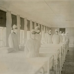
Spatial comparison of London’s three waves of Spanish flu
1218PDF: 558HTML: 445 -
Socioeconomic determinants of pandemics: a spatial methodological approach with evidence from COVID-19 in Nice, France
401PDF: 113Supplementary materials: 31HTML: 3 -
Enhancing GeoHealth: A step-by-step procedure for spatiotemporal disease mapping
934PDF: 354Supplementary Materials: 151HTML: 177 -
Investigating local variation in disease rates within high-rate regions identified using smoothing
509PDF: 349Supplementary Materials: 95HTML: 13 -
Global Mpox spread due to increased air travel
2075PDF: 632HTML: 245 -
Spatial pattern analysis of the impact of community food environments on foetal macrosomia, preterm births and low birth weight
899PDF: 526Supplementary Materials: 106HTML: 59 -
Spatial autocorrelation and heterogenicity of demographic and healthcare factors in the five waves of COVID-19 epidemic in Thailand
1315PDF: 769Supplementary Materials: 111HTML: 33 -
Report-back for geo-referenced environmental data: A case study on personal monitoring of temperature in outdoor workers
2342PDF: 1046APPENDIX: 337HTML: 76 -
Spatial analysis of antimicrobial resistance in the environment. A systematic review
2528PDF: 861Supplementary Materials: 207HTML: 58 -
Sentiment analysis using a lexicon-based approach in Lisbon, Portugal
1018PDF: 291Supplementary Materials: 143HTML: 69


