FOR AUTHORS
Search
Search Results
##search.searchResults.foundPlural##
-
-
Spatial air pollution modelling for a West-African town
3488PDF: 1401SUPPL. MATERIAL: 395HTML: 1078 -
Spatial analysis of antimicrobial resistance in the environment. A systematic review
2257PDF: 730Supplementary Materials: 164HTML: 58 -
Where to place emergency ambulance vehicles: use of a capacitated maximum covering location model with real call data
2353PDF: 650Supplementary Materials: 114HTML: 75 -
Mapping livestock systems, bovine and caprine diseases in Mayo-Kebbi Ouest Province, Chad
2985PDF: 985Supplementary Materials: 536HTML: 180 -
A topological multilayer model of the human body
3020PDF: 1043HTML: 1548 -
Spatial dispersal of Aedes albopictus mosquitoes captured by the modified sticky ovitrap in Selangor, Malaysia
1465PDF: 615Annex I-VI: 103HTML: 58 -
Preferential sampling in veterinary parasitological surveillance
1971PDF: 1444APPENDIX: 532HTML: 1032 -
Zoning the territory of the Republic of Kazakhstan as to the risk of rabies among various categories of animals
2560PDF: 1125APPENDIX: 583HTML: 1441 -
Access to the COVID-19 services during the pandemic - a scoping review
2032PDF: 526Appendix: 221HTML: 99 -
Balancing geo-privacy and spatial patterns in epidemiological studies
3737PDF: 1076APPENDIX: 476HTML: 946 -
Haemodialysis services in the northeastern region of Iran
3935PDF: 1045HTML: 901 -
Spatial pattern evolution of Aedes aegypti breeding sites in an Argentinean city without a dengue vector control programme
3661PDF: 1263APPENDIX: 477HTML: 1533 -
Habitat suitability map of Ixodes ricinus tick in France using multi-criteria analysis
5770PDF: 2170Appendix: 286HTML: 230 -
Assessing spatial patterns of HIV prevalence and interventions in semi-urban settings in South Africa. Implications for spatially targeted interventions
1904PDF: 461Supplementary 1: 83Supplementary 2: 228HTML: 145 -
Prediction of dengue cases using the attention-based long short-term memory (LSTM) approach
1710PDF: 816Supplementary Materials: 105HTML: 34 -
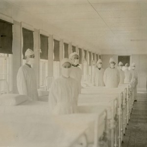
Spatial comparison of London’s three waves of Spanish flu
1117PDF: 476HTML: 311


