Skip to main content Skip to main navigation menu Skip to site footer
Geospatial Health

eISSN 1970-7096 - pISSN 1827-1987

  • About the Journal
  • Publication Ethics
  • Editorial Board
  • Current Issue
  • Archives
  • Special on COVID-19
  • Special Issues
    • Overview
  • Register
  • Login
  • Search
  • Contacts
  • News

Editor-in-Chief: Robert Bergquist

0.9
Impact Factor 2024
2.2
CiteScore 2024
Submit
an article
  1. Home /
  2. Search

Search

Advanced filters
Published After
Published Before

Search Results

##search.searchResults.foundPlural##
  • Place and health infrastructure in the Gulf Cooperation Council: A systematic scoping review of GIS applications in health

    Dari Alhuwail, Saad AlSharrah, Neil T Coffee, Faisal H Al-Refaei, Mark Daniel
    29-12-2020
    https://doi.org/10.4081/gh.2020.887
    2558
    PDF: 982
    HTML: 47
  • MALAREO: a user-driven project

    Michael T. Gebreslasie, Ides Bauwens
    04-11-2015
    https://doi.org/10.4081/gh.2015.329
    2656
    PDF: 1098
    HTML: 973
  • Exploring geomasking methods for geoprivacy: a pilot study in an environment with built features

    Alok Tiwari, Sohail Ahmad, Emad Qurunflah, Mansour Helmi, Ayad Almaimani, Alaa Alaidroos, Majed Mustafa Hallawani
    17-10-2023
    https://doi.org/10.4081/gh.2023.1205
    944
    PDF: 518
    HTML: 146
  • A conceptional model integrating geographic information systems (GIS) and social media data for disease exposure assessment

    Jerry Enoe , Michael Sutherland, Dexter Davis, Bheshem Ramlal, Charisse Griffith-Charles , Keston H. Bhola, Elsai Mati Asefa
    28-03-2024
    https://doi.org/10.4081/gh.2024.1264
    2532
    PDF: 649
    HTML: 62
  • The use of geographic information system as a tool for schistosomiasis surveillance in the province of Davao del Norte, the Philippines

    Vicente Y. Belizario, John Paul Caesar R. delos Trinos, Berne Silawan, Chiqui M. De Veyra, Agapito Hornido, Hansel Amoguis, Dominic Basalo, Cherry Dema-ala, Irenn Mantilla, Rosele Layan
    06-11-2017
    https://doi.org/10.4081/gh.2017.540
    7043
    PDF: 1817
    HTML: 2115
  • A geographical information system for the management of the aquaculture data in the Adriatic Sea - the Strengthening of Centres for Aquaculture Production and Safety surveillance in the Adriatic countries experience: Present capabilities, tools and functions

    Susanna Tora, Silvio Sacchini, Eddy Listeš, Tanja Bogdanović, Alessio Di Lorenzo, Muhamed Smajlović, Ahmed Smajlović, Jelena V. Filipović, Vildana Tahirović, Danijela Å uković, Bojan Beljkas, Ardian Xinxo, Renis Maçi, Patrizia Colangeli, Federica Di Giacinto, Annamaria Conte
    08-11-2017
    https://doi.org/10.4081/gh.2017.593
    2349
    PDF: 879
    APPENDIX: 357
    HTML: 844
  • Spatial air pollution modelling for a West-African town

    Sirak Zenebe Gebreab, Danielle Vienneau, Christian Feigenwinter, Hampâté Bâ, Guéladio Cissé, Ming-Yi Tsai
    26-11-2015
    https://doi.org/10.4081/gh.2015.321
    3528
    PDF: 1484
    SUPPL. MATERIAL: 410
    HTML: 1078
  • Spatial analysis of antimicrobial resistance in the environment. A systematic review

    Patrick Spets, Karin Ebert, Patrik Dinnétz
    25-05-2023
    https://doi.org/10.4081/gh.2023.1168
    2370
    PDF: 789
    Supplementary Materials: 178
    HTML: 58
  • Application of geo-spatial technology in schistosomiasis modelling in Africa: a review

    Tawanda Manyangadze, Moses John Chimbari, Michael Gebreslasie, Samson Mukaratirwa
    04-11-2015
    https://doi.org/10.4081/gh.2015.326
    4059
    PDF: 2154
    HTML: 2155
  • Where to place emergency ambulance vehicles: use of a capacitated maximum covering location model with real call data

    Soheil Hashtarkhani, Stephen A. Matthews, Ping Yin, Alireza Mohammadi, Shahab Mohammad Ebrahimi, Mahmood Tara, Behzad Kiani
    20-07-2023
    https://doi.org/10.4081/gh.2023.1198
    2464
    PDF: 716
    Supplementary Materials: 132
    HTML: 77
  • Understanding needs and barriers to using geospatial tools for public health policymaking in China

    Dohyeong Kim, Yingyuan Zhang, Chang Kil Lee
    07-05-2018
    https://doi.org/10.4081/gh.2018.594
    1710
    PDF: 843
    HTML: 293
  • Mapping livestock systems, bovine and caprine diseases in Mayo-Kebbi Ouest Province, Chad

    Kella Douzouné, Joseph Oloukoi, Ismaila Toko Imorou, Toure Gorgui Ba, Derrick Chefor Ymele Demeveng
    03-02-2025
    https://doi.org/10.4081/gh.2025.1365
    3151
    PDF: 1033
    Supplementary Materials: 554
    HTML: 186
  • Impact of walkability with regard to physical activity in the prevention of diabetes

    Carlos Mena, César Sepúlveda, Yony Ormazábal, Eduardo Fuentes, Iván Palomo
    03-11-2017
    https://doi.org/10.4081/gh.2017.595
    3374
    PDF: 1035
    HTML: 1067
  • A topological multilayer model of the human body

    Antonio Barbeito, Marco Painho, Pedro Cabral, João O'Neill
    04-11-2015
    https://doi.org/10.4081/gh.2015.375
    3045
    PDF: 1100
    HTML: 1549
  • A geographical information system model to define COVID-19 problem areas with an analysis in the socio-economic context at the regional scale in the North of Spain

    Olga De Cos, Valentín Castillo-Salcines, David Cantarero-Prieto
    18-03-2022
    https://doi.org/10.4081/gh.2022.1067
    1491
    PDF: 462
    HTML: 35
  • Assessment of primary healthcare accessibility and inequality in north-eastern Kazakhstan

    Askhat Shaltynov, Jorge Rocha , Ulzhan Jamedinova, Ayan Myssayev
    13-05-2022
    https://doi.org/10.4081/gh.2022.1046
    2752
    PDF: 1103
    HTML: 292
  • Spatial dispersal of Aedes albopictus mosquitoes captured by the modified sticky ovitrap in Selangor, Malaysia

    Muhammad Aidil Roslan, Romano Ngui, Muhammad Fathi Marzuki, Indra Vythilingam, Aziz Shafie, Sabri Musa, Wan Yusoff Wan Sulaiman
    11-05-2022
    https://doi.org/10.4081/gh.2022.1025
    1513
    PDF: 658
    Annex I-VI: 120
    HTML: 60
  • Earth observation in support of malaria control and epidemiology: MALAREO monitoring approaches

    Jonas Franke, Michael Gebreslasie, Ides Bauwens, Julie Deleu, Florian Siegert
    03-06-2015
    https://doi.org/10.4081/gh.2015.335
    4210
    PDF: 1486
    HTML: 1215
  • Geographic clustering of elderly people with above-norm anthropometric measurements and blood chemistry

    Carlos Mena, Eduardo Fuentes, Yony Ormazábal, Iván Palomo
    11-05-2017
    https://doi.org/10.4081/gh.2017.523
    2741
    PDF: 1155
    HTML: 883
  • Asthmatic symptoms and air pollution: a panel study on children living in the Italian Po Valley

    Andrea Ranzi, Anna Freni Sterrantino, Francesco Forastiere, Claudio Sartini, Giovanna Casale, Rino Cavallini, Aldo De Togni, Lorenza Gallo, Paolo Lauriola
    26-11-2015
    https://doi.org/10.4081/gh.2015.366
    3243
    PDF: 1427
    HTML: 1239
  • Mapping displaced populations with reference to social vulnerabilities for post-disaster public health management

    Junaid Ahmad, Anees Ahmad, Mokbul Morshed Ahmad, Nafees Ahmad
    27-11-2017
    https://doi.org/10.4081/gh.2017.576
    3399
    PDF: 1132
    HTML: 1415
  • Understanding COVID-19: comparison of spatio-temporal analysis methods used to study epidemic spread patterns in the United States

    Chunhui Liu, Xiaodi Su, Zhaoxuan Dong, Xingyu Liu, Chunxia Qiu
    25-05-2023
    https://doi.org/10.4081/gh.2023.1200
    1066
    PDF: 579
    HTML: 53
  • Space-time clustering characteristics of dengue based on ecological, socio-economic and demographic factors in northern Sri Lanka

    Sumiko Anno, Keiji Imaoka, Takeo Tadono, Tamotsu Igarashi, Subramaniam Sivaganesh, Selvam Kannathasan, Vaithehi Kumaran, Sinnathamby Noble Surendran
    26-11-2015
    https://doi.org/10.4081/gh.2015.376
    3520
    PDF: 2049
    HTML: 1261
  • GeoCREV: veterinary geographical information system and the development of a practical sub-national spatial data infrastructure

    Nicola Ferrè, Paolo Mulatti, Matteo Mazzucato, Monica Lorenzetto, Matteo Trolese, Dario Pandolfo, Piero Vio, Guido Sitta, Stefano Marangon
    275-283
    01-05-2011
    https://doi.org/10.4081/gh.2011.180
    1462
    PDF: 948
  • Preferential sampling in veterinary parasitological surveillance

    Lorenzo Cecconi, Annibale Biggeri, Laura Grisotto, Veronica Berrocal, Laura Rinaldi, Vincenzo Musella, Giuseppe Cringoli, Dolores Catelan
    18-04-2016
    https://doi.org/10.4081/gh.2016.412
    1981
    PDF: 1491
    APPENDIX: 549
    HTML: 1032
  • Geographic distribution of canine heartworm (Dirofilaria immitis) infection in stray dogs of eastern Romania

    Lavinia Ciucă, Vincenzo Musella, Liviu D. Miron, Maria Paola Maurelli, Giuseppe Cringoli, Antonio Bosco, Laura Rinaldi
    21-11-2016
    https://doi.org/10.4081/gh.2016.499
    4205
    PDF: 1537
    HTML: 2249
  • Spatial epidemiology of cancer: a review of data sources, methods and risk factors

    Rita Roquette, Marco Painho, Baltazar Nunes
    08-05-2017
    https://doi.org/10.4081/gh.2017.504
    7645
    PDF: 3145
    HTML: 2654
  • Comparison of complete and spatial sampling frames for estimation of the prevalence of hypertension and diabetes mellitus

    Vasna Joshua, Kamaraj Pattabi, Yuvaraj Jeyaraman, Prabhdeep Kaur, Tarun Bhatnagar, Suresh Arunachalam, Sabarinathan Ramasamy, Venkateshprabhu Janagaraj, Manoj V Murhekar
    30-11-2022
    https://doi.org/10.4081/gh.2022.1097
    2030
    PDF: 782
    HTML: 112
  • Topographic distribution of gastritis in heavy pigs investigated by a geographic information system approach

    Ernesto Pascotto, Diego Capraro, Paolo Tomè, Mauro Spanghero
    31-05-2016
    https://doi.org/10.4081/gh.2016.436
    1975
    PDF: 969
    HTML: 856
  • Mapping, cluster detection and evaluation of risk factors of ovine toxoplasmosis in Southern Italy

    Roberto Condoleo, Vincenzo Musella, Maria Paola Maurelli, Antonio Bosco, Giuseppe Cringoli, Laura Rinaldi
    31-05-2016
    https://doi.org/10.4081/gh.2016.432
    2478
    PDF: 1152
    HTML: 1220
  • Cystic echinococcosis in cattle dairy farms: spatial distribution and epidemiological dynamics

    Antonio Scala, Antonio Bosco, Anna Paola Pipia, Claudia Tamponi, Vincenzo Musella, Nicola Costanzo, Francesco Testoni, Antonio Montisci, Giovanni Mocci, Alessandro Longhi, Laura Tilocca, Laura Rinaldi, Giuseppe Cringoli, Antonio Varcasia
    29-05-2017
    https://doi.org/10.4081/gh.2017.562
    2301
    PDF: 1060
    HTML: 1003
  • Is missing geographic positioning system data in accelerometry studies a problem, and is imputation the solution?

    Kristin Meseck, Marta M. Jankowska, Jasper Schipperijn, Loki Natarajan, Suneeta Godbole, Jordan Carlson, Michelle Takemoto, Katie Crist, Jacqueline Kerr
    31-05-2016
    https://doi.org/10.4081/gh.2016.403
    2187
    PDF: 1379
    HTML: 890
  • Predicting the spatial distribution of Biomphalaria straminea, a potential intermediate host for Schistosoma mansoni, in China

    Mohamed R. Habib, Yun-Hai Guo, Shan Lv, Wen-Biao Gu, Xiao-Heng Li, Xiao-Nong Zhou
    29-11-2016
    https://doi.org/10.4081/gh.2016.453
    3751
    PDF: 1363
    HTML: 1132
  • Environmental modelling of visceral leishmaniasis by susceptibility-mapping using neural networks: a case study in north-western Iran

    Mohammadreza Rajabi, Ali Mansourian, Petter Pilesjö, Ahad Bazmani
    179-191
    01-11-2014
    https://doi.org/10.4081/gh.2014.15
    7128
    PDF: 1430
  • Prehistoric human migrations: a prospective subject for modelling using geographical information systems

    Robert Bergquist
    25-05-2023
    https://doi.org/10.4081/gh.2023.1210
    1233
    PDF: 419
    HTML: 27
  • Mapping malaria risk using geographic information systems and remote sensing: The case of Bahir Dar City, Ethiopia

    Amare Sewnet Minale, Kalkidan Alemu
    07-05-2018
    https://doi.org/10.4081/gh.2018.660
    6750
    PDF: 2247
    HTML: 1154
  • Assessment of the supply/demand balance of medical resources in Beijing from the perspective of hierarchical diagnosis and treatment

    Yuehan Jiang, Xinyu Cai, Yanhui Wang, Junwu Dong, Mengqin Yang
    13-10-2023
    https://doi.org/10.4081/gh.2023.1228
    1272
    PDF: 603
    HTML: 106
  • Zoning the territory of the Republic of Kazakhstan as to the risk of rabies among various categories of animals

    Sarsenbay K. Abdrakhmanov, Akhmetzhan A. Sultanov, Kanatzhan K. Beisembayev, Fedor I. Korennoy, Dosym B. Кushubaev, Ablaikhan S. Каdyrov
    31-05-2016
    https://doi.org/10.4081/gh.2016.429
    2584
    PDF: 1169
    APPENDIX: 607
    HTML: 1441
  • Using object-based image analysis to map commercial poultry operations from high resolution imagery to support animal health outbreaks and events

    Susan Maroney, MaryJane McCool-Eye, Andrew Fox, Christopher Burdett
    10-12-2020
    https://doi.org/10.4081/gh.2020.919
    2374
    PDF: 785
    HTML: 104
  • Comparison of GPS imputation methods in environmental health research

    Sungsoon Hwang, Kashica Webber-Ritchey, Elizabeth Moxley
    29-08-2022
    https://doi.org/10.4081/gh.2022.1081
    2078
    PDF: 881
    HTML: 31
  • Design and implementation of a spatial database for analysis of wheelchair accessibility

    Peter Nezval, Takeshi Shirabe
    24-03-2025
    https://doi.org/10.4081/gh.2025.1324
    1325
    PDF: 320
    HTML: 89
  • Spatial and temporal changes in household structure locations using high-resolution satellite imagery for population assessment: an analysis in southern Zambia, 2006-2011

    Timothy Shields, Jessie Pinchoff, Jailos Lubinda, Harry Hamapumbu, Kelly Searle, Tamaki Kobayashi, Philip E. Thuma, William J. Moss, Frank C. Curriero
    31-05-2016
    https://doi.org/10.4081/gh.2016.410
    2053
    PDF: 965
    HTML: 903
  • Defining health catchment areas in Jeddah city, Saudi Arabia: an example demonstrating the utility of geographical information systems

    Abdulkader A. Murad
    151-160
    01-05-2008
    https://doi.org/10.4081/gh.2008.239
    1874
    PDF: 1101
  • A conceptual holding model for veterinary applications

    Nicola Ferrè, Werner Kuhn, Massimo Rumor, Stefano Marangon
    583-596
    01-05-2014
    https://doi.org/10.4081/gh.2014.48
    2120
    PDF: 855
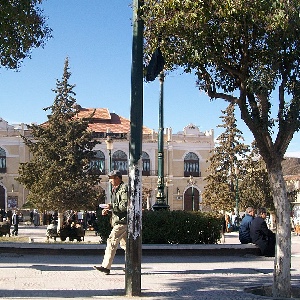
  • https://commons.wikimedia.org/wiki/File:Theatre_batna_-_panoramio.jpg

    Identification and analysis of spatial access disparities related to primary healthcare in Batna City, Algeria

    Ahmed Akakba, Belkacem Lahmar
    14-12-2023
    https://doi.org/10.4081/gh.2023.1238
    1524
    PDF: 489
    HTML: 33
  • Smartphone-assisted spatial data collection improves geographic information quality: pilot study using a birth records dataset

    Xiaohui Xu, Hui Hu, Sandie Ha, Daikwon Han
    23-11-2016
    https://doi.org/10.4081/gh.2016.482
    2749
    PDF: 862
    HTML: 813
  • Spatial analysis for the epidemiological study of cardiovascular diseases: A systematic literature search

    Carlos Mena, Cesar Sepúlveda, Eduardo Fuentes, Yony Ormazábal, Iván Palomo
    07-05-2018
    https://doi.org/10.4081/gh.2018.587
    4915
    PDF: 2303
    HTML: 737
  • Spatial analysis of cutaneous leishmaniasis in an endemic area of Iran based on environmental factors

    Roghieh Ramezankhani, Nooshin Sajjadi, Roya Nezakati Esmaeilzadeh, Seyed Ali Jozi, Mohammad Reza Shirzadi
    08-11-2017
    https://doi.org/10.4081/gh.2017.578
    2507
    PDF: 923
    HTML: 916
  • Revealing spatio-temporal patterns of rabies spread among various categories of animals in the Republic of Kazakhstan, 2010-2013

    Sarsenbay K. Abdrakhmanov, Kanatzhan K. Beisembayev, Fedor I. Кorennoy, Gulzhan N. Yessembekova, Dosym B. Кushubaev, Ablaikhan S. Кadyrov
    31-05-2016
    https://doi.org/10.4081/gh.2016.455
    2277
    PDF: 1184
    HTML: 1284
  • Spatial distribution of triatomines (Reduviidae: Triatominae) in urban areas of the city of Salvador, Bahia, Brazil

    Karine de Souza O. Santana, Maria Emília Bavia, Artur Dias Lima, Isabel Cristina S. Guimarães, Ênio Silva Soares, Marta Mariana Nascimento Silva, Jorge Mendonça, Moara de Santana Martin
    199-203
    01-05-2011
    https://doi.org/10.4081/gh.2011.172
    1990
    PDF: 899
  • A review of spatial technologies with applications for malaria transmission modelling and control in Africa

    Michael T. Gebreslasie
    26-11-2015
    https://doi.org/10.4081/gh.2015.328
    5912
    PDF: 2418
    HTML: 3074
  • Geo-referencing livestock farms as tool for studying cystic echinococcosis epidemiology in cattle and water buffaloes from southern Italy

    Giuseppe Cringoli, Laura Rinaldi, Vincenzo Musella, Vincenzo Veneziano, Maria Paola Maurelli, Francesco Di Pietro, Michele Frisiello, Salvatore Di Pietro
    105-111
    01-11-2007
    https://doi.org/10.4081/gh.2007.259
    2296
    PDF: 968
  • Space-time epidemiology and effect of meteorological parameters on influenza-like illness in Phitsanulok, a northern province in Thailand

    Prakash Madhav Nimbalkar, Nitin Kumar Tripathi
    21-11-2016
    https://doi.org/10.4081/gh.2016.447
    2133
    PDF: 1202
    HTML: 1119
  • Space-time scan statistics of 2007-2013 dengue incidence in Cimahi city, Indonesia

    Pandji Wibawa Dhewantara, Andri Ruliansyah, M. Ezza Azmi Fuadiyah, Endang Puji Astuti, Mutiara Widawati
    27-11-2015
    https://doi.org/10.4081/gh.2015.373
    5127
    PDF: 1804
    HTML: 1017
  • Access to the COVID-19 services during the pandemic - a scoping review

    Ahmad Raeesi, Behzad Kiani, Azam Hesami, Ladan Goshayeshi, Neda Firouraghi, Shahab MohammadEbrahimi, Soheil Hashtarkhani
    28-03-2022
    https://doi.org/10.4081/gh.2022.1079
    2113
    PDF: 578
    Appendix: 250
    HTML: 100
  • Remote sensing and climate data as a key for understanding fasciolosis transmission in the Andes: review and update of an ongoing interdisciplinary project

    Márius V. Fuentes
    59-70
    01-11-2006
    https://doi.org/10.4081/gh.2006.281
    1612
    PDF: 971
  • Immunity to poliovirus in Afghanistan: A household sampling method for serological assessment based on geographical information systems

    Amalia Mendes, Ari Whiteman, Benjamin Nygren, Brian Kaplan, Imtiaz Hussain, Sajid Soofi, Maureen Martinez, Noha H. Farag
    29-11-2022
    https://doi.org/10.4081/gh.2022.1107
    1012
    PDF: 622
    HTML: 35
  • GIS modeling for canine dirofilariosis risk assessment in central Italy

    Michele Mortarino, Vincenzo Musella, Valeria Costa, Claudio Genchi, Giuseppe Cringoli, Laura Rinaldi
    253-261
    01-05-2008
    https://doi.org/10.4081/gh.2008.248
    2017
    PDF: 873
  • Measuring high-density built environment for public health research: Uncertainty with respect to data, indicator design and spatial scale

    Guibo Sun, Chris Webster, Michael Y. Ni, Xiaohu Zhang
    07-05-2018
    https://doi.org/10.4081/gh.2018.653
    2261
    PDF: 1209
    HTML: 205
  • Mapping and prediction of schistosomiasis in Nigeria using compiled survey data and Bayesian geospatial modelling

    Uwem F. Ekpo, Eveline Hürlimann, Nadine Schur, Akinola. S. Oluwole, Eniola M. Abe, Margaret A. Mafe, Obiageli J. Nebe, Sunday Isiyaku, Francisca Olamiju, Mukaila Kadiri, Temitope O.S. Poopola, Eka I. Braide, Yisa Saka, Chiedu F. Mafiana, Thomas K. Kristensen, Jürg Utzinger, Penelope Vounatsou
    355-366
    01-05-2013
    https://doi.org/10.4081/gh.2013.92
    5213
    PDF: 1870
  • Spatial access disparities to primary health care in rural and remote Australia

    Matthew Richard McGrail, John Stirling Humphreys
    04-11-2015
    https://doi.org/10.4081/gh.2015.358
    21895
    PDF: 9077
    HTML: 2316
  • Access to dialysis services: A systematic mapping review based on geographical information systems

    Benyamin Hoseini, Nasser Bagheri, Behzad Kiani, Amirabbas Azizi, Hamed Tabesh, Mahmood Tara
    07-05-2018
    https://doi.org/10.4081/gh.2018.577
    3577
    PDF: 1374
    HTML: 204
  • Using geographical information systems for defining the accessibility to health care facilities in Jeddah City, Saudi Arabia

    Abdulkader A. Murad
    S661-S669
    01-12-2014
    https://doi.org/10.4081/gh.2014.295
    3117
    PDF: 1982
  • Vulnerability to COVID-19 in Pernambuco, Brazil: A geospatial evaluation supported by multiple-criteria decision aid methodology

    Ciro José Jardim de Figueiredo, Caroline Maria de Miranda Mota, Amanda Gadelha Ferreira Rosa, Arthur Pimentel Gomes de Souza, Simone Maria da Silva Lima
    14-01-2022
    https://doi.org/10.4081/gh.2022.1000
    2385
    PDF: 411
    HTML: 44
  • Spatial analysis of the prevalence of schistosomiasis in an endemic coastal area in north-eastern Brazil

    Allan D. Santos, Jonhnatas Silva, Ana Caroline Lima, Márcio Santos, Shirley Lima, Monalisa Amor, Carlos Santos, Arthur Vasconcelos, Silvio Dolabella, Karina C.G.M. Araújo
    27-11-2017
    https://doi.org/10.4081/gh.2017.570
    2916
    PDF: 836
    HTML: 864
  • Simulation of the spatial distribution of urban populations based on first-aid call data

    Yinan Zhou, Qin Zhong Zhu, Li Luo
    29-12-2020
    https://doi.org/10.4081/gh.2020.768
    1386
    PDF: 533
    HTML: 14
  • Balancing geo-privacy and spatial patterns in epidemiological studies

    Chien-Chou Chen, Jen-Hsiang Chuang, Da-Wei Wang, Chien-Min Wang, Bo-Cheng Lin, Ta-Chien Chan
    08-11-2017
    https://doi.org/10.4081/gh.2017.573
    3776
    PDF: 1115
    APPENDIX: 494
    HTML: 946
  • Spatio-temporal trends and distribution patterns of typhoid disease in Uganda from 2012 to 2017

    Kamukama Ismail, Gilbert Maiga, Denis Ssebuggwawo, Peter Nabende, Ali Mansourian
    07-01-2021
    https://doi.org/10.4081/gh.2020.860
    2980
    PDF: 978
    HTML: 23
  • A 24-year exploratory spatial data analysis of Lyme disease incidence rate in Connecticut, USA

    Abolfazl Mollalo, Jason K. Blackburn, Lillian R. Morris, Gregory E. Glass
    08-11-2017
    https://doi.org/10.4081/gh.2017.588
    2729
    PDF: 1210
    HTML: 1000
  • Use of geographical information systems for delimiting health service areas in China

    Xuechen Xiong, Li Luo
    11-05-2017
    https://doi.org/10.4081/gh.2017.486
    2135
    PDF: 1039
    HTML: 1009
  • Fine scale mapping of malaria infection clusters by using routinely collected health facility data in urban Dar es Salaam, Tanzania

    Yeromin P. Mlacha, Prosper P. Chaki, Alpha D. Malishee, Victoria M. Mwakalinga, Nicodem J. Govella, Alex J. Limwagu, John M. Paliga, Daniel F. Msellemu, Zawadi D. Mageni, Dianne J. Terlouw, Gerry F. Killeen, Stefan Dongus
    11-05-2017
    https://doi.org/10.4081/gh.2017.494
    4334
    PDF: 1504
    HTML: 1287
  • Spatial analysis and prediction of the flow of patients to public health centres in a middle-sized Spanish city

    Isabel Ramos, Juan J. Cubillas, Francisco R. Feito, Tomas Ureña
    21-11-2016
    https://doi.org/10.4081/gh.2016.452
    1982
    PDF: 1084
    HTML: 1118
  • Haemodialysis services in the northeastern region of Iran

    Behzad Kiani, Nasser Bagheri, Ahmad Tara, Benyamin Hoseini, Mahmoud Tara
    11-05-2017
    https://doi.org/10.4081/gh.2017.561
    3971
    PDF: 1097
    HTML: 901
  • Helmintic infections in water buffaloes on Italian farms: a spatial analysis

    Laura Rinaldi, Vincenzo Musella, Vincenzo Veneziano, Renato U. Condoleo, Giuseppe Cringoli
    233-239
    01-05-2009
    https://doi.org/10.4081/gh.2009.223
    1977
    PDF: 957
  • Spatial association and modelling of under-5 mortality in Thailand, 2020

    Suparerk Suerungruang, Kittipong Sornlorm, Wongsa Laohasiriwong, Roshan Kumar Mahato
    31-08-2023
    https://doi.org/10.4081/gh.2023.1220
    1253
    PDF: 725
    HTML: 45
  • Hospital distribution in a metropolitan city: assessment by a geographical information system grid modelling approach

    Kwang-Soo Lee, Kyeong-Jun Moon
    537-544
    01-05-2014
    https://doi.org/10.4081/gh.2014.43
    1787
    PDF: 1110
  • The effects of the Health Insurance Portability and Accountability Act privacy rule on influenza research using geographical information systems

    Norisse Tellman, Eric R. Litt, Caprice Knapp, Aaron Eagan, Jing Cheng, Lewis J. Jr Radonovich
    3-9
    01-11-2010
    https://doi.org/10.4081/gh.2010.182
    2222
    PDF: 878
  • The spatial distribution pattern of human immunodeficiency virus/acquired immune deficiency syndrome in China

    Ying Wang, Yongli Yang, Xuezhong Shi, Saicai Mao, Nian Shi, Xiaoqing Hui
    31-05-2016
    https://doi.org/10.4081/gh.2016.414
    3828
    PDF: 1603
    HTML: 2246
  • A geographical information system-based analysis of cancer mortality and population exposure to coal mining activities in West Virginia, United States of America

    Michael Hendryx, Evan Fedorko, Andrew Anesetti-Rothermel
    243-256
    01-05-2010
    https://doi.org/10.4081/gh.2010.204
    3526
    PDF: 1731
  • Spatial pattern evolution of Aedes aegypti breeding sites in an Argentinean city without a dengue vector control programme

    Manuel O. Espinosa, Francisco Polop, Camilo H. Rotela, Marcelo Abril, Carlos M. Scavuzzo
    21-11-2016
    https://doi.org/10.4081/gh.2016.471
    3713
    PDF: 1364
    APPENDIX: 498
    HTML: 1534
  • New insights into the application of geographical information systems and remote sensing in veterinary parasitology

    Laura Rinaldi, Vincenzo Musella, Annibale Biggeri, Giuseppe Cringoli
    33-47
    01-11-2006
    https://doi.org/10.4081/gh.2006.279
    3331
    PDF: 1504
  • An analysis of the process and results of manual geocode correction

    Yolanda J. McDonald, Michael Schwind, Daniel W. Goldberg, Amanda Lampley, Cosette M. Wheeler
    11-05-2017
    https://doi.org/10.4081/gh.2017.526
    2179
    PDF: 906
    HTML: 973
  • The dog and cat population on Maio Island, Cape Verde: characterisation and prediction based on household survey and remotely sensed imagery

    Ana Carolina Lopes Antunes, Els Ducheyne, Ward Bryssinckx, Sara Vieira, Manuel Malta, Yolanda Vaz, Telmo Nunes, Koen Mintiens
    04-11-2015
    https://doi.org/10.4081/gh.2015.386
    2989
    PDF: 1028
    HTML: 1208
  • The potential for emergence of Chagas disease in the United States

    Rebecca Click Lambert, Korine N. Kolivras, Lynn M. Resler, Carlyle C. Brewster, Sally L. Paulson
    227-239
    01-05-2008
    https://doi.org/10.4081/gh.2008.246
    2344
    PDF: 1334
  • Prevalence of hypertension in Thailand: Hotspot clustering detected by spatial analysis

    Wongsa Laohasiriwong, Nattapong Puttanapong, Atthawit Singsalasang
    07-05-2018
    https://doi.org/10.4081/gh.2018.608
    3731
    PDF: 1802
    HTML: 575
  • Mapping urban and peri-urban breeding habitats of Aedes mosquitoes using a fuzzy analytical hierarchical process based on climatic and physical parameters

    Muhammad Shahzad Sarfraz, Nagesh K. Tripathi, Fazlay S. Faruque, Usama Ijaz Bajwa, Asanobu Kitamoto, Marc Souris
    S685-S697
    01-12-2014
    https://doi.org/10.4081/gh.2014.297
    10460
    PDF: 2533
  • Comparing the perception with the reality of walking in a hilly environment: an accessibility method applied to a University campus in Hong Kong

    Guibo Sun, Robert Haining, Hui Lin, Nicolas M. Oreskovic, Jie He
    18-05-2015
    https://doi.org/10.4081/gh.2015.340
    5051
    PDF: 1757
    HTML: 1886
  • Spatial autocorrelation and stratified heterogeneity in the evaluation of breast cancer risk inequity and socioeconomic factors analysis in China: Evidence from Nanchang, Jiangxi Province

    Yaqi Wang, Zhiwei Wan
    17-05-2022
    https://doi.org/10.4081/gh.2022.1078
    1480
    PDF: 809
    HTML: 119
  • Spatial autocorrelation pattern of COVID-19 vaccine coverage in Thailand 2021 and 2022

    Sarayu Muntaphan, Kittipong Sornlorm
    13-05-2025
    https://doi.org/10.4081/gh.2025.1368
    916
    PDF: 185
    HTML: 45
  • Geographically weighted regression for modelling the accessibility to the public hospital network in Concepción Metropolitan Area, Chile

    Marcela Martínez Bascuñán, Carolina Rojas Quezada
    22-11-2016
    https://doi.org/10.4081/gh.2016.451
    3573
    PDF: 1637
    HTML: 2153
  • A geospatial analysis of cardiometabolic diseases and their risk factors considering environmental features in a midsized city in Argentina

    Micaela Natalia Campero, Carlos Matías Scavuzzo, Veronica Andreo, María Sol Mileo, Micaela Belén Franzois, María Georgina Oberto, Carla Gonzalez Rodriguez, María Daniela Defagó
    23-10-2023
    https://doi.org/10.4081/gh.2023.1212
    1234
    PDF: 642
    HTML: 13
  • Land surface temperature predicts mortality due to chronic obstructive pulmonary disease: a study based on climate variables and impact machine learning

    Alireza Mohammadi, Bardia Mashhoodi, Ali Shamsoddini, Elahe Pishgar, Robert Bergquist
    26-03-2025
    https://doi.org/10.4081/gh.2025.1319
    1753
    PDF: 330
    HTML: 73
  • Assessing spatial patterns of HIV prevalence and interventions in semi-urban settings in South Africa. Implications for spatially targeted interventions

    Lucy Chimoyi, Zvifadzo Matsena-Zingoni, Salome Charalambous, Edmore Marinda, Samuel Manda, Eustasius Musenge
    29-08-2022
    https://doi.org/10.4081/gh.2022.1084
    1959
    PDF: 487
    Supplementary 1: 101
    Supplementary 2: 251
    HTML: 145
  • Geocoding precision of birth records from 2008 to 2017 in Kentucky, USA

    Courtney J. Walker, Steven R. Browning, Jeffrey E. Levy, W. Jay Christian
    06-05-2022
    https://doi.org/10.4081/gh.2022.1020
    1271
    PDF: 564
    HTML: 12
  • Predicting frequency distribution and influence of sociodemographic and behavioral risk factors of Schistosoma mansoni infection and analysis of co-infection with intestinal parasites

    Carla V.V. Rollemberg, Marília M.B.L. Silva, Karla C. Rollemberg, Fábio R. Amorim, Nayanna M.N. Lessa, Marcos D.S. Santos, Acácia M.B. Souza, Enaldo V. Melo, Roque P. Almeida, Ângela M. Silva, Guilherme L. Werneck, Mario A. Santos, José A.P. Almeida, Amélia R. Jesus
    18-05-2015
    https://doi.org/10.4081/gh.2015.303
    4590
    PDF: 1840
    HTML: 1079
  • Prediction of dengue cases using the attention-based long short-term memory (LSTM) approach

    Mokhalad A. Majeed, Helmi Z. M. Shafri, Aimrun Wayayok, Zed Zulkafli
    25-05-2023
    https://doi.org/10.4081/gh.2023.1176
    1817
    PDF: 892
    Supplementary Materials: 128
    HTML: 43
  • Validation of an interactive map assessing the potential spread of Galba truncatula as intermediate host of Fasciola hepatica in Switzerland

    Rhea Baggenstos, Tobias Dahinden, Paul R. Torgerson, Hansruedi Bär, Christina Rapsch, Gabriela Knubben-Schweizer
    31-05-2016
    https://doi.org/10.4081/gh.2016.418
    2177
    PDF: 964
    HTML: 1002
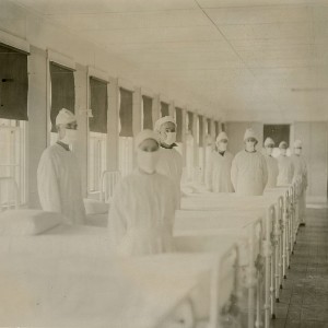
  • Spatial comparison of London’s three waves of Spanish flu

    Walter Peterson
    19-10-2023
    https://doi.org/10.4081/gh.2023.1235
    1157
    PDF: 519
    HTML: 357
  • Application of geospatial information systems (GIS) for assessment of the distribution of periodontal disease in Makassar City, South Sulawesi Province, Indonesia

    Fuad Husain Akbar, Nur Amaliyah Riyadh
    07-11-2023
    https://doi.org/10.4081/gh.2023.1240
    1346
    PDF: 508
    HTML: 9
  • Identification and mapping of objects targeted for surveillance and their role as risk factors for brucellosis in livestock farms in Kazakhstan

    Aizada A. Mukhanbetkaliyeva, Ablaikhan S. Kadyrov, Yersyn Y. Mukhanbetkaliyev, Zhanat S. Adilbekov, Assylbek A. Zhanabayev, Assem Z. Abenova, Fedor I. Korennoy, Sarsenbay K. Abdrakhmanov
    08-11-2024
    https://doi.org/10.4081/gh.2024.1335
    1137
    PDF: 359
    HTML: 47
1 - 100 of 292 items 1 2 3 > >> 

authors

FOR AUTHORS
  • SUBMIT YOUR PAPER
  • Benefits for Authors
  • Guide for Authors
  • How to write a scientific paper
  • How to write a Review article
  • Article Processing Charge
  • Index of Authors

reviewers

FOR REVIEWERS
  • Benefits for Reviewers
  • How to review
  • Thanks to Reviewers

indexing

INDEXING
  • PubMed
  • Scopus
  • Web of Science
  • DOAJ
  • Google Scholar
  • OpenAlex
  • Analytics

Categories

    • Contents
    • Original Articles
    • Corrections
    • Editorials
    • Gnosis(GIS) symposium
    • Reviews

vhealths

vHealth Section

Geospatial Health
opens the new vHealth section. Discover vHealth

Vol. 20 No. 1 (2025)
Dengue risk-mapping in an Amazonian locality in Colombia based on regression and multi-criteria analysis
Maria Camila Lesmes et al.
4 June 2025
Vol. 20 No. 1 (2025)
The future of spatial epidemiology in the AI era: enhancing machine learning approaches with explicit spatial structure
Nima Kianfar et al.
4 June 2025
Vol. 20 No. 1 (2025)
Typhoid fever in Jakarta, Indonesia 2017-2023: spatial clustering and seasonality of hospitalization data to inform better intervention
Mujiyanto Mujiyanto et al.
15 May 2025
Vol. 20 No. 1 (2025)
Spatial autocorrelation pattern of COVID-19 vaccine coverage in Thailand 2021 and 2022
Sarayu Muntaphan et al.
13 May 2025
Vol. 20 No. 1 (2025)
Spatial multilevel modelling male partners’ influence on women’s modern contraceptive use: a study in Angola and Zambia
Kabeya Clement Mulamba
12 May 2025
Vol. 20 No. 1 (2025)
Risk discrepancies in COVID-19-related community environments based on spatiotemporal monitoring
Jihong Zhang et al.
28 April 2025

Keywords

Geospatial Health

is an Open Access, peer-reviewed journal published by PAGEPress®, Pavia, Italy. All credits and honors to PKP for their OJS.

pISSN: 1827-1987
eISSN: 1970-7096

Info

  • About
  • Editorial Board
  • News
  • Advertising

Info Submission

  • Submission
  • Guidelines For Authors

Our App Is Free For Anyone!

Themes by Openjournaltheme.com

© PAGEPress 2008-2025    •    PAGEPress® is a registered trademark property of PAGEPress srl, Italy    •    VAT: IT02125780185    •    Privacy