


















































FOR AUTHORS
Search
Search Results
##search.searchResults.foundPlural##
-
Geospatial tools and data for health service delivery: opportunities and challenges across the disaster management cycle
6658PDF: 924Supplementary Materials: 305HTML: 128 -
Geospatial Health: achievements, innovations, priorities
2109PDF: 804HTML: 103 -

Factors associated with the spatial distribution of leprosy: a systematic review of the published literature
1148PDF: 531Supplementary materials: 104HTML: 25 -

Mapping livestock systems, bovine and caprine diseases in Mayo-Kebbi Ouest Province, Chad
3983PDF: 1488Supplementary Materials: 640HTML: 206 -

Moran’s I and Geary’s C: investigation of the effects of spatial weight matrices for assessing the distribution of infectious diseases
2702PDF: 960Supplementary materials: 241HTML: 122 -
Enhancing GeoHealth: A step-by-step procedure for spatiotemporal disease mapping
1300PDF: 527Supplementary Materials: 212HTML: 454 -

Spatial inequalities in cancer with special reference to lung cancer across Europe and their implications for environmental health policy
833PDF: 436Supplementary materials: 53HTML: 18 -

Reduction of latency in geospatial analysis of air quality: a classical modelling approach inspired by quantum principles
201PDF: 80Supplementary Materials: 33HTML: 3 -

Access to the COVID-19 services during the pandemic - a scoping review
2681PDF: 906Appendix: 366HTML: 132 -

Monitoring techniques in the capture and adoption of dogs and cats
4348PDF: 1976HTML: 1496 -

Does the Geohealth domain require a body of knowledge?
2072PDF: 752HTML: 37 -

Assessing spatial patterns of HIV prevalence and interventions in semi-urban settings in South Africa. Implications for spatially targeted interventions
2538PDF: 625Supplementary 1: 188Supplementary 2: 409HTML: 181 -
Measuring geographic access to emergency obstetric care: a comparison of travel time estimates modelled using Google Maps Directions API and AccessMod in three Nigerian conurbations
3432PDF: 1111Supplementary Materials: 189HTML: 256 -

Where to place emergency ambulance vehicles: use of a capacitated maximum covering location model with real call data
3803PDF: 1322Supplementary Materials: 971HTML: 194 -

Venomous snakebite risk and its implications in Zacatecas State, Mexico 2007-2017
1056PDF: 438Supplementary materials: 149HTML: 12 -

Intra-urban differences underlying leprosy spatial distribution in central Brazil: geospatial techniques as potential tools for surveillance
1694PDF: 782Supplementary Materials: 149HTML: 26 -

Making the most of spatial information in health: a tutorial in Bayesian disease mapping for areal data
7604PDF: 2638APPENDIX: 1217HTML: 5550 -

Investigating local variation in disease rates within high-rate regions identified using smoothing
824PDF: 528Supplementary Materials: 150HTML: 41 -

Spatiality in small area estimation: A new structure with a simulation study
1360PDF: 666Supplementary materials: 214HTML: 30 -

Spatial pattern evolution of Aedes aegypti breeding sites in an Argentinean city without a dengue vector control programme
4342PDF: 1731APPENDIX: 588HTML: 1545 -

Sentiment analysis using a lexicon-based approach in Lisbon, Portugal
1438PDF: 679Supplementary Materials: 236HTML: 86 -

Spatial accessibility to basic public health services in South Sudan
9504PDF: 3027APPENDIX: 7625HTML: 1179 -

Optimizing allocation of colorectal cancer screening hospitals in Shanghai: a geospatial analysis
2524PDF: 1267Supplementary Materials: 216HTML: 30 -

Balancing geo-privacy and spatial patterns in epidemiological studies
4212PDF: 1374APPENDIX: 581HTML: 965 -
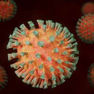
Spatial autocorrelation and heterogenicity of demographic and healthcare factors in the five waves of COVID-19 epidemic in Thailand
1895PDF: 1067Supplementary Materials: 184HTML: 111 -

Ecological characterization of a cutaneous leishmaniasis outbreak through remotely sensed land cover changes
1956PDF: 1108Appendix: 215HTML: 42