Skip to main content Skip to main navigation menu Skip to site footer
Geospatial Health

eISSN 1970-7096 - pISSN 1827-1987

  • About the Journal
  • Publication Ethics
  • Editorial Board
  • Current Issue
  • Archives
  • Special on COVID-19
  • Special Issues
    • Overview
  • Register
  • Login
  • Search
  • Contacts
  • News

Editor-in-Chief: Robert Bergquist

1.0
Impact Factor 2023
2.4
CiteScore 2023
Submit
an article
  1. Home /
  2. Search

Search

Advanced filters
Published After
Published Before

Search Results

##search.searchResults.foundPlural##
  • A geographical information system for the management of the aquaculture data in the Adriatic Sea - the Strengthening of Centres for Aquaculture Production and Safety surveillance in the Adriatic countries experience: Present capabilities, tools and functions

    Susanna Tora, Silvio Sacchini, Eddy Listeš, Tanja Bogdanović, Alessio Di Lorenzo, Muhamed Smajlović, Ahmed Smajlović, Jelena V. Filipović, Vildana Tahirović, Danijela Å uković, Bojan Beljkas, Ardian Xinxo, Renis Maçi, Patrizia Colangeli, Federica Di Giacinto, Annamaria Conte
    08-11-2017
    https://doi.org/10.4081/gh.2017.593
    2283
    PDF: 808
    APPENDIX: 327
    HTML: 844
  • Earth observation in support of malaria control and epidemiology: MALAREO monitoring approaches

    Jonas Franke, Michael Gebreslasie, Ides Bauwens, Julie Deleu, Florian Siegert
    03-06-2015
    https://doi.org/10.4081/gh.2015.335
    4134
    PDF: 1417
    HTML: 1215
  • Spatial air pollution modelling for a West-African town

    Sirak Zenebe Gebreab, Danielle Vienneau, Christian Feigenwinter, Hampâté Bâ, Guéladio Cissé, Ming-Yi Tsai
    26-11-2015
    https://doi.org/10.4081/gh.2015.321
    3438
    PDF: 1349
    SUPPL. MATERIAL: 384
    HTML: 1078
  • Assessing the relationship between environmental factors and malaria vector breeding sites in Swaziland using multi-scale remotely sensed data

    Sabelo Nick Dlamini, Jonas Franke, Penelope Vounatsou
    03-06-2015
    https://doi.org/10.4081/gh.2015.302
    3871
    PDF: 1555
    HTML: 1739
  • Stratifying land use/land cover for spatial analysis of disease ecology and risk: an example using object-based classification techniques

    David E. Koch, Rhett L. Mohler, Douglas G. Goodin
    15-28
    01-11-2007
    https://doi.org/10.4081/gh.2007.251
    2073
    PDF: 918
  • Random forest variable selection in spatial malaria transmission modelling in Mpumalanga Province, South Africa

    Thandi Kapwata, Michael T. Gebreslasie
    16-11-2016
    https://doi.org/10.4081/gh.2016.434
    3794
    PDF: 1452
    APPENDIX 1: 401
    APPENDIX 2: 387
    HTML: 1637
  • Urban environmental clustering to assess the spatial dynamics of Aedes aegypti breeding sites

    Guillermo Albrieu-Llinás, Manuel O. Espinosa, Agustín Quaglia, Marcelo Abril, Carlos Marcelo Scavuzzo
    07-05-2018
    https://doi.org/10.4081/gh.2018.654
    2721
    PDF: 1119
    HTML: 185
  • Vulnerability to COVID-19 in Pernambuco, Brazil: A geospatial evaluation supported by multiple-criteria decision aid methodology

    Ciro José Jardim de Figueiredo, Caroline Maria de Miranda Mota, Amanda Gadelha Ferreira Rosa, Arthur Pimentel Gomes de Souza, Simone Maria da Silva Lima
    14-01-2022
    https://doi.org/10.4081/gh.2022.1000
    2290
    PDF: 343
    HTML: 43
  • Sentiment analysis using a lexicon-based approach in Lisbon, Portugal

    Iuria Betco, Ana Isabel Ribeiro, David S. Vale, Luis Encalada-Abarca, Cláudia M. Viana, Jorge Rocha
    24-04-2025
    https://doi.org/10.4081/gh.2025.1344
    481
    PDF: 115
    Supplementary Materials: 53
    HTML: 30
  • Satellite-based forest monitoring: spatial and temporal forecast of growing index and short-wave infrared band

    Caroline Bayr, Heinz Gallaun, Ulrike Kleb, Birgit Kornberger, Martin Steinegger, Martin Winter
    18-04-2016
    https://doi.org/10.4081/gh.2016.310
    2142
    PDF: 1150
    HTML: 2011
  • Comparison of GPS imputation methods in environmental health research

    Sungsoon Hwang, Kashica Webber-Ritchey, Elizabeth Moxley
    29-08-2022
    https://doi.org/10.4081/gh.2022.1081
    2008
    PDF: 820
    HTML: 31
  • Mapping malaria risk using geographic information systems and remote sensing: The case of Bahir Dar City, Ethiopia

    Amare Sewnet Minale, Kalkidan Alemu
    07-05-2018
    https://doi.org/10.4081/gh.2018.660
    6630
    PDF: 2139
    HTML: 1132
  • Air quality classification and its temporal trend in Tehran, Iran, 2002-2012

    Raheleh Saniei, Ali Zangiabadi, Mohammad Sharifikia, Yousef Ghavidel
    31-05-2016
    https://doi.org/10.4081/gh.2016.442
    4375
    PDF: 1258
    HTML: 2568
  • Habitat suitability map of Ixodes ricinus tick in France using multi-criteria analysis

    Isabelle Lebert, Séverine Bord, Christine Saint-Andrieux, Eva Cassar, Patrick Gasqui, Frédéric Beugnet, Karine Chalvet-Monfray, Sophie O. Vanwambeke, Gwenaël Vourc’h, Magalie René-Martellet
    17-05-2022
    https://doi.org/10.4081/gh.2022.1058
    5590
    PDF: 2101
    Appendix: 264
    HTML: 216
  • A methodology for combining multiple commercial data sources to improve measurement of the food and alcohol environment: applications of geographical information systems

    Dara D. Mendez, Jessica Duell, Sarah Reiser, Deborah Martin, Robert Gradeck, Anthony Fabio
    71-96
    01-11-2014
    https://doi.org/10.4081/gh.2014.7
    2432
    PDF: 1131
  • Improving AfriPop dataset with settlement extents extracted from RapidEye for the border region comprising South-Africa, Swaziland and Mozambique

    Julie Deleu, Jonas Franke, Michael Gebreslasie, Catherine Linard
    04-11-2015
    https://doi.org/10.4081/gh.2015.336
    2345
    PDF: 956
    HTML: 1095
  • Application of decision tree for prediction of cutaneous leishmaniasis incidence based on environmental and topographic factors in Isfahan Province, Iran

    Roghieh Ramezankhani, Nooshin Sajjadi, Roya Nezakati Esmaeilzadeh, Seyed Ali Jozi, Mohammad Reza Shirzadi
    08-05-2018
    https://doi.org/10.4081/gh.2018.664
    1587
    PDF: 738
    HTML: 157
  • COVID-19 vaccine prioritization based on district classification in Yogyakarta Province, Indonesia

    Syifa Hanifa, Diana Puspitasari, Cahyadi Ramadhan, Karina Oriza Herastuti
    14-01-2022
    https://doi.org/10.4081/gh.2022.1010
    2301
    PDF: 431
    HTML: 40
  • Socio-spatial vulnerability index of type 2 diabetes mellitus in Mexico in 2020

    Enríque Ibarra-Zapata, Darío Gaytán-Hernández, Yolanda Terán-Figueroa, Verónica Gallegos-García, Carmen del Pilar Suárez-Rodríguez, Sergio Zarazúa Guzmán, Omar Parra Rodríguez
    27-01-2025
    https://doi.org/10.4081/gh.2025.1348
    3342
    PDF: 1220
    HTML: 223
  • Comparison of single- and multi-scale models for the prediction of the Culicoides biting midge distribution in Germany

    Renke Lühken, Jörn Martin Gethmann, Petra Kranz, Pia Steffenhagen, Christoph Staubach, Franz J. Conraths, Ellen Kiel
    31-05-2016
    https://doi.org/10.4081/gh.2016.405
    3068
    PDF: 953
    HTML: 1457
  • Spatial pattern evolution of Aedes aegypti breeding sites in an Argentinean city without a dengue vector control programme

    Manuel O. Espinosa, Francisco Polop, Camilo H. Rotela, Marcelo Abril, Carlos M. Scavuzzo
    21-11-2016
    https://doi.org/10.4081/gh.2016.471
    3616
    PDF: 1225
    APPENDIX: 455
    HTML: 1532
  • Land surface temperature predicts mortality due to chronic obstructive pulmonary disease: a study based on climate variables and impact machine learning

    Alireza Mohammadi, Bardia Mashhoodi, Ali Shamsoddini, Elahe Pishgar, Robert Bergquist
    26-03-2025
    https://doi.org/10.4081/gh.2025.1319
    1330
    PDF: 247
    HTML: 41
  • Spatial epidemiology of cancer: a review of data sources, methods and risk factors

    Rita Roquette, Marco Painho, Baltazar Nunes
    08-05-2017
    https://doi.org/10.4081/gh.2017.504
    7485
    PDF: 2991
    HTML: 2640
  • Developing operational algorithms using linear and non-linear squares estimation in Python® for the identification of Culex pipiens and Culex restuans in a mosquito abatement district (Cook County, Illinois, USA)

    Benjamin G. Jacob, Weidong Gu, Erik X. Caamano, Robert J. Novak
    157-176
    01-05-2009
    https://doi.org/10.4081/gh.2009.218
    1322
    PDF: 787
  • Validation of an interactive map assessing the potential spread of Galba truncatula as intermediate host of Fasciola hepatica in Switzerland

    Rhea Baggenstos, Tobias Dahinden, Paul R. Torgerson, Hansruedi Bär, Christina Rapsch, Gabriela Knubben-Schweizer
    31-05-2016
    https://doi.org/10.4081/gh.2016.418
    1959
    PDF: 908
    HTML: 1002
  • Investigating local variation in disease rates within high-rate regions identified using smoothing

    Matthew Tuson, Matthew Yap, David Whyatt
    25-05-2023
    https://doi.org/10.4081/gh.2023.1144
    396
    PDF: 254
    Supplementary Materials: 56
    HTML: 5
  • Spatiotemporal analysis of the relationship between socioeconomic factors and stroke in the Portuguese mainland population under 65 years old

    André Oliveira, Antònio J.R. Cabral, Jorge M. Mendes, Maria R.O. Martins, Pedro Cabral
    04-11-2015
    https://doi.org/10.4081/gh.2015.365
    2990
    PDF: 1261
    HTML: 1217
  • Spatial access disparities to primary health care in rural and remote Australia

    Matthew Richard McGrail, John Stirling Humphreys
    04-11-2015
    https://doi.org/10.4081/gh.2015.358
    21398
    PDF: 8877
    HTML: 2308
  • Spatial prediction of the risk of exposure to Echinococcus spp. among schoolchildren and dogs in Ningxia Hui Autonomous Region, People's Republic of China

    Angela M. Cadavid Restrepo, Yu Rong Yang, Donald P. McManus, Darren J. Gray, Tamsin S. Barnes, Gail M. Williams, Ricardo J. Soares Magalhães, Archie C.A. Clements
    07-05-2018
    https://doi.org/10.4081/gh.2018.644
    1897
    PDF: 738
    HTML: 79
  • Fine-scale mapping of vector habitats using very high resolution satellite imagery: a liver fluke case-study

    Els De Roeck, Frieke Van Coillie, Robert De Wulf, Karen Soenen, Johannes Charlier, Jozef Vercruysse, Wouter Hantson, Els Ducheyne, Guy Hendrickx
    S671-S683
    01-12-2014
    https://doi.org/10.4081/gh.2014.296
    3345
    PDF: 2382
  • Geocoding precision of birth records from 2008 to 2017 in Kentucky, USA

    Courtney J. Walker, Steven R. Browning, Jeffrey E. Levy, W. Jay Christian
    06-05-2022
    https://doi.org/10.4081/gh.2022.1020
    1199
    PDF: 499
    HTML: 11
  • Public domain small-area cancer incidence data for New York State, 2005-2009

    Francis P. Boscoe, Thomas O. Talbot, Martin Kulldorff
    18-04-2016
    https://doi.org/10.4081/gh.2016.304
    1926
    PDF: 1013
    HTML: 858
  • Using object-based image analysis to map commercial poultry operations from high resolution imagery to support animal health outbreaks and events

    Susan Maroney, MaryJane McCool-Eye, Andrew Fox, Christopher Burdett
    10-12-2020
    https://doi.org/10.4081/gh.2020.919
    2266
    PDF: 704
    HTML: 89
  • The food environment and adult obesity in US metropolitan areas

    Akihiko Michimi, Michael C. Wimberly
    26-11-2015
    https://doi.org/10.4081/gh.2015.368
    5684
    PDF: 2498
    HTML: 1203
  • Redefining climate regions in the United States of America using satellite remote sensing and machine learning for public health applications

    Alexander Liss, Magaly Koch, Elena N. Naumova
    S467-S659
    01-12-2014
    https://doi.org/10.4081/gh.2014.294
    2993
    PDF: 1199
  • Spatial analysis of the regional variation of hypertensive disease mortality and its socio-economic correlates in South Korea

    Seong-Yong Park, Jin-Mi Kwak, Eun-Won Seo, Kwang-Soo Lee
    31-05-2016
    https://doi.org/10.4081/gh.2016.420
    2777
    PDF: 1542
    HTML: 1366
  • Spatial accessibility to basic public health services in South Sudan

    Peter M. Macharia, Paul O. Ouma, Ezekiel G. Gogo, Robert W. Snow, Abdisalan M. Noor
    11-05-2017
    https://doi.org/10.4081/gh.2017.510
    7966
    PDF: 2286
    APPENDIX: 5442
    HTML: 1115
  • Differences in spatial patterns of long-term care depending on severity in Hokkaido, Japan

    Kazuki Ohashi, Kensuke Fujiwara, Takumi Tanikawa, Kyohei Bando, Tomohiro Aoki, Katsuhiko Ogasawara
    16-05-2022
    https://doi.org/10.4081/gh.2022.1077
    1233
    PDF: 488
    HTML: 27
  • Geostatistical modelling of the malaria risk in Mozambique: effect of the spatial resolution when using remotely-sensed imagery

    Federica Giardina, Jonas Franke, Penelope Vounatsou
    26-11-2015
    https://doi.org/10.4081/gh.2015.333
    3398
    PDF: 1397
    HTML: 1175
  • The Labin Region, an ecologically vulnerable geographical area in Croatia: Mortality characteristics in an area polluted by industrial over a 40-year period

    Toni Buterin, Robert Doričić, Dalibor Broznić, Tanja Ćorić, Amir Muzur
    17-05-2022
    https://doi.org/10.4081/gh.2022.1082
    779
    PDF: 367
    HTML: 59
  • Validation of a spatial liver fluke model under field conditions in Ireland

    Amalia Naranjo Lucena, María Pía Munita Corbalán, Ana María Martínez-Ibeas, Guy McGrath, Riona Sayers, Grace Mulcahy, Annetta Zintl
    07-05-2018
    https://doi.org/10.4081/gh.2018.641
    2125
    PDF: 879
    HTML: 127
  • Neonatal mortality in East Africa and West Africa: a geographic analysis of district-level demographic and health survey data

    Sue C. Grady, April N. Frake, Qiong Zhang, Matlhogonolo Bene, Demetrice R. Jordan, Joshua Vertalka, Thania C. Dossantos, Ameen Kadhim, Judith Namanya, Lisa-Marie Pierre, Yi Fan, Peiling Zhou, Fatoumata B. Barry, Libbey Kutch
    26-05-2017
    https://doi.org/10.4081/gh.2017.501
    8621
    PDF: 4025
    HTML: 2160
  • Understanding the relationship between land use and land cover and malaria in Nepal

    Shreejana Bhattarai, Korine N. Kolivras, Kabita Ghimire, Yang Shao
    29-12-2020
    https://doi.org/10.4081/gh.2020.855
    1736
    PDF: 778
    HTML: 29
  • Spatial clustering of colorectal cancer in Malaysia

    Sharifah Saffinas Syed Soffian, Azmawati Mohammed Nawi, Rozita Hod, Khairul Nizam Abdul Maulud, Ahmad Tarmizi Mohd Azmi, Mohd Hazrin Hasim Hashim, Huan-Keat Chan, Muhammad Radzi Abu Hassan
    25-05-2023
    https://doi.org/10.4081/gh.2023.1158
    1242
    PDF: 536
    HTML: 6
  • Comparing the accuracy of food outlet datasets in an urban environment

    Michelle S. Wong, Jennifer M. Peyton, Timothy M. Shields, Frank C. Curriero, Kimberly A. Gudzune
    11-05-2017
    https://doi.org/10.4081/gh.2017.546
    2012
    PDF: 927
    HTML: 942
  • The geographic environment and the frequency of falling: a study of mortality outcomes in elderly people in China

    Yi Huang, Chen Li, Xianjing Lu, Yue Wang
    25-05-2023
    https://doi.org/10.4081/gh.2023.1180
    555
    PDF: 362
    HTML: 3
  • Ecological characterization of a cutaneous leishmaniasis outbreak through remotely sensed land cover changes

    Verónica Andreo, Juan Rosa, Karina Ramos, O. Daniel Salomón
    06-05-2022
    https://doi.org/10.4081/gh.2022.1033
    1452
    PDF: 665
    Appendix: 90
    HTML: 30
  • Child mortality inequalities across Rwanda districts: a geoadditive continuous-time survival analysis

    François Niragire, Thomas N.O. Achia, Alexandre Lyambabaje, Joseph Ntaganira
    11-05-2017
    https://doi.org/10.4081/gh.2017.450
    2860
    PDF: 1406
    HTML: 1377
  • Geographical distribution and spatio-temporal patterns of hospitalization due to dengue infection at a leading specialist hospital in Malaysia

    Gary K.K. Low, Panayoti Papapreponis, Ridzuan M. Isa, Seng Chiew Gan, Hui Yee Chee, Kian Keong Te, Nadia M. Hatta
    07-05-2018
    https://doi.org/10.4081/gh.2018.642
    2186
    PDF: 852
    APPENDIX: 376
    HTML: 102
  • Rivers and flooded areas identified by medium-resolution remote sensing improve risk prediction of the highly pathogenic avian influenza H5N1 in Thailand

    Weerapong Thanapongtharm, Thomas P. Van Boeckel, Chandrashekhar Biradar, Xiangming Xiao, Marius Gilbert
    193-201
    01-11-2013
    https://doi.org/10.4081/gh.2013.66
    1573
    PDF: 983
  • Reducing bias in risk indices for COVID-19

    Michał Paweł Michalak, Jack Cordes, Agnieszka Kulawik, Sławomir Sitek, Sławomir Pytel, Elżbieta Zuzańska-Żyśko, Radosław Wieczorek
    14-01-2022
    https://doi.org/10.4081/gh.2022.1013
    2592
    PDF: 255
    Appendix: 319
    HTML: 28
  • Spatio-temporal trends and distribution patterns of typhoid disease in Uganda from 2012 to 2017

    Kamukama Ismail, Gilbert Maiga, Denis Ssebuggwawo, Peter Nabende, Ali Mansourian
    07-01-2021
    https://doi.org/10.4081/gh.2020.860
    2852
    PDF: 881
    HTML: 23
  • MALAREO: a user-driven project

    Michael T. Gebreslasie, Ides Bauwens
    04-11-2015
    https://doi.org/10.4081/gh.2015.329
    2587
    PDF: 1025
    HTML: 972
  • Cystic echinococcosis in slaughtered cattle in Sardinia: a retrospective epidemiological study and spatial analysis

    Diego Brundu, Daniela Aloi, Sandro Rolesu, Toni Piseddu, Giovanna Masala
    285-291
    01-05-2012
    https://doi.org/10.4081/gh.2012.146
    1320
    PDF: 722
  • Assessing spatial inequalities in accessing community pharmacies: a mixed geographically weighted approach

    Alexander Domnich, Lucia Arata, Daniela Amicizia, Alessio Signori, Roberto Gasparini, Donatella Panatto
    16-11-2016
    https://doi.org/10.4081/gh.2016.457
    2975
    PDF: 1364
    HTML: 1300
  • Measuring geographic access to emergency obstetric care: a comparison of travel time estimates modelled using Google Maps Directions API and AccessMod in three Nigerian conurbations

    Peter M. Macharia, Kerry L.M. Wong, Lenka Beňová, Jia Wang, Prestige Tatenda Makanga, Nicolas Ray, Aduragbemi Banke-Thomas
    27-05-2024
    https://doi.org/10.4081/gh.2024.1266
    1987
    PDF: 585
    Supplementary Materials: 80
    HTML: 159
  • Spatial correlates of COVID-19 first wave across continental Portugal

    Bruno Barbosa, Melissa Silva, César Capinha, Ricardo A.C. Garcia, Jorge Rocha
    23-06-2022
    https://doi.org/10.4081/gh.2022.1073
    1167
    PDF: 359
    HTML: 41
  • Assessment of malaria transmission changes in Africa, due to the climate impact of land use change using Coupled Model Intercomparison Project Phase 5 earth system models

    Adrian M. Tompkins, Luca Caporaso
    31-03-2016
    https://doi.org/10.4081/gh.2016.380
    3597
    PDF: 1603
    HTML: 1268
  • Understanding the spatial non-stationarity in the relationships between malaria incidence and environmental risk factors using Geographically Weighted Random Forest: A case study in Rwanda

    Gilbert Nduwayezu, Pengxiang Zhao, Clarisse Kagoyire, Lina Eklund, Jean Pierre Bizimana, Petter Pilesjo, Ali Mansourian
    25-05-2023
    https://doi.org/10.4081/gh.2023.1184
    2130
    PDF: 1145
    HTML: 129
  • Modelling the domestic poultry population in the United States: A novel approach leveraging remote sensing and synthetic data methods

    Kelly A. Patyk, Mary J. McCool-Eye, David D. South, Christopher L. Burdett, Susan A. Maroney, Andrew Fox, Grace Kuiper, Sheryl Magzamen
    10-12-2020
    https://doi.org/10.4081/gh.2020.913
    3238
    PDF: 1064
    HTML: 127
  • A review of spatial technologies with applications for malaria transmission modelling and control in Africa

    Michael T. Gebreslasie
    26-11-2015
    https://doi.org/10.4081/gh.2015.328
    5826
    PDF: 2288
    HTML: 3056
  • Geomapping of trematode-induced granulomatous anterior uveitis - a newly identified cause of blindness among children in the Pudukkottai district of the Tamil Nadu State, India

    Jayakumar Duraisamy, Sivakumar Kavitha, Sivakumar Rathinam, Gnanam Vasanthi
    55-63
    01-11-2009
    https://doi.org/10.4081/gh.2009.210
    1169
    PDF: 823
  • GeoMedStat: an integrated spatial surveillance system to track air pollution and associated healthcare events

    Fazlay S. Faruque, Hui Li, Worth B. Williams, Lance A. Waller, Bruce T. Brackin, Lei Zhang, Kim A. Grimes, Richard W. Finley
    S631-S646
    01-12-2014
    https://doi.org/10.4081/gh.2014.293
    3269
    PDF: 1363
  • Are clusters of mental retardation correlated with clusters of developmental delay?

    Huiling Zhen, Suzanne McDermott, Andrew B. Lawson, C. Marjorie Aelion
    17-26
    01-11-2009
    https://doi.org/10.4081/gh.2009.207
    1162
    PDF: 595
  • Predictive risk mapping of human leptospirosis using support vector machine classification and multilayer perceptron neural network

    Mehrdad Ahangarcani, Mahdi Farnaghi, Mohammad Reza Shirzadi, Petter Pilesjö, Ali Mansourian
    14-05-2019
    https://doi.org/10.4081/gh.2019.711
    2420
    PDF: 1114
    APPENDIX: 284
    HTML: 170
  • Geospatial epidemiology of coronary artery disease treated with percutaneous coronary intervention in Crete, Greece

    Evangelos Melidoniotis, Kleomenis Kalogeropoulos, Andreas Tsatsaris, Michail Zografakis-Sfakianakis, George Lazopoulos, Nikolaos Tzanakis, Ioannis Anastasiou, Emmanouil Skalidis
    16-05-2024
    https://doi.org/10.4081/gh.2024.1251
    2059
    PDF: 396
    HTML: 49
  • Assessing the spatial accessibility of hospital care in Sichuan Province, China

    Jay Pan, Huiran Liu, Xiuli Wang, Hongmei Xie, Paul L. Delamater
    27-11-2015
    https://doi.org/10.4081/gh.2015.384
    5052
    PDF: 2049
    HTML: 1616
  • Cancer incidence in Priolo, Sicily: a spatial approach for estimation of industrial air pollution impact

    Lucia Fazzo, Mario Carere, Francesco Tisano, Caterina Bruno, Achille Cernigliaro, Maria Rita Cicero, Pietro Comba, Maria Luisa Contrino, Marco De Santis, Fabrizio Falleni, Vincenzo Ingallinella, Anselmo Madeddu, Ida Marcello, Carlo Regalbuto, Giovanna Sciacca, Maria Eleonora Soggiu, Amerigo Zona
    18-04-2016
    https://doi.org/10.4081/gh.2016.320
    4752
    PDF: 1735
    HTML: 1906
  • Risk areas for hepatitis A, B and C in the municipality of Maringá, Paraná State, Brazil 2007-2010

    Valéria Miranda Avanzi, Udelysses Janete Veltrini Fonzar, Eraldo Schunk Silva, Jorge Juarez Vieira Teixeira, Dennis Armando Bertolini
    08-05-2018
    https://doi.org/10.4081/gh.2018.607
    1792
    PDF: 646
    HTML: 128
  • Landscape attributes driving avian influenza virus circulation in the Lake Alaotra region of Madagascar

    Laure Guerrini, Mathilde C. Paul, Lucas Leger, Harentsoaniaina R. Andriamanivo, Olivier F. Maminiaina, Marion Jourdan, Sophie Molia, René Rakotondravao, Véronique Chevalier
    445-453
    01-05-2014
    https://doi.org/10.4081/gh.2014.33
    2397
    PDF: 977
  • Vaccine hesitancy in East Malaysia (Sabah): A survey of the national COVID-19 immunisation programme

    Adi Jafar, Mohammad Tahir Mapa, Nordin Sakke, Ramli Dollah, Eko Prayitno Joko, Colonius Atang, Syahruddin Awang Ahmad, Chong Vun Hung, Fionna Geogre
    14-01-2022
    https://doi.org/10.4081/gh.2022.1037
    5465
    PDF: 826
    HTML: 237
  • Modelling of the distribution of Biomphalaria glabrata and Biomphalaria straminea in the metropolitan region of Recife, Pernambuco, Brazil

    Verônica Santos Barbosa, Ricardo José de Paula Souza e Guimarães, Rodrigo Moraes Loyo, Constança Simões Barbosa
    25-11-2016
    https://doi.org/10.4081/gh.2016.490
    2684
    PDF: 1064
    HTML: 1596
  • Geospatial tools and data for health service delivery: opportunities and challenges across the disaster management cycle

    Fleur Hierink, Nima Yaghmaei, Mirjam I. Bakker, Nicolas Ray, Marc van den Homberg
    29-10-2024
    https://doi.org/10.4081/gh.2024.1284
    5776
    PDF: 479
    Supplementary Materials: 146
    HTML: 85
  • Rapid GIS-based profiling of West Nile virus transmission: defining environmental factors associated with an urbansuburban outbreak in Northeast Ohio, USA

    A. Desiree LaBeaud, Ann-Marie Gorman, Joe Koonce, Christopher Kippes, John McLeod, Joe Lynch, Timothy Gallagher, Charles H. King, Anna M. Mandalakas
    215-225
    01-05-2008
    https://doi.org/10.4081/gh.2008.245
    2051
    PDF: 743
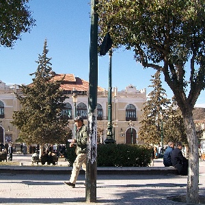
  • https://commons.wikimedia.org/wiki/File:Theatre_batna_-_panoramio.jpg

    Identification and analysis of spatial access disparities related to primary healthcare in Batna City, Algeria

    Ahmed Akakba, Belkacem Lahmar
    14-12-2023
    https://doi.org/10.4081/gh.2023.1238
    1367
    PDF: 403
    HTML: 32
  • The future of general practitioner care in Lower Saxony, Germany: an analysis of actual vs target states using a GIS-based floating catchment area method

    Jonas Schoo, Frank Schüssler
    19-02-2025
    https://doi.org/10.4081/gh.2025.1339
    1591
    PDF: 426
    HTML: 67
  • Can landscape metrics help determine the Culicoides imicola distribution in Italy?

    Carla Ippoliti, Marius Gilbert, Sabine Vanhuysse, Maria Goffredo, Giuseppe Satta, Eléonore Wolff, Annamaria Conte
    267-277
    01-11-2013
    https://doi.org/10.4081/gh.2013.72
    1620
    PDF: 762
  • Spatial associations between chronic kidney disease and socio-economic factors in Thailand

    Juree Sansuk, Kittipong Sornlorm
    30-01-2024
    https://doi.org/10.4081/gh.2024.1246
    5913
    PDF: 709
    HTML: 841
  • Spatiotemporal epidemiology of COVID-19 from an epidemic course perspective

    Yuling Huang, Shujuan Yang, Yuxuan Zou, Jianming Su, Canglang Wu, Bo Zhong, Peng Jia
    10-02-2022
    https://doi.org/10.4081/gh.2022.1023
    2788
    PDF: 367
    HTML: 23
  • Spatio-temporal outbreaks of campylobacteriosis and the role of fresh-milk vending machines in the Czech Republic: A methodological study

    Lukáš Marek, Vít Pászto
    08-11-2017
    https://doi.org/10.4081/gh.2017.572
    2464
    PDF: 644
    HTML: 830
  • Mapping the risk for transmission of urban schistosomiasis in the Brazilian Northeast

    Emília Carolle Azevedo de Oliveira, Iris Edna Pereira da Silva, Ricardo José Ferreira, Ricardo José de Paula Souza e Guimarães, Elainne Christine de Souza Gomes, Constança Simões Barbosa
    29-12-2020
    https://doi.org/10.4081/gh.2020.861
    2189
    PDF: 832
    HTML: 54
  • Spatial analysis and prediction of the flow of patients to public health centres in a middle-sized Spanish city

    Isabel Ramos, Juan J. Cubillas, Francisco R. Feito, Tomas Ureña
    21-11-2016
    https://doi.org/10.4081/gh.2016.452
    1936
    PDF: 968
    HTML: 1117
  • Dynamic location model for designated COVID-19 hospitals in China

    Wang Fei, Yuan Linghong, Zhang Weigang, Zhang Ruihan
    29-10-2024
    https://doi.org/10.4081/gh.2024.1310
    816
    PDF: 209
    Supplementary Materials: 108
    HTML: 70
  • Spatial analysis of incidence of cutaneous melanoma in the Friuli Venezia Giulia region in the period 1995-2005

    Lorenzo Cecconi, Anna Busolin, Fabio Barbone, Diego Serraino, Alessandra Chiarugi, Annibale Biggeri, Dolores Catelan
    18-04-2016
    https://doi.org/10.4081/gh.2016.422
    2252
    PDF: 1449
    HTML: 959
  • On the geographic access to healthcare, beyond proximity

    Songyuan Deng, Kevin Bennett
    28-09-2023
    https://doi.org/10.4081/gh.2023.1199
    1771
    PDF: 597
    HTML: 52
  • Spatial association between the incidence rate of COVID-19 and poverty in the São Paulo municipality, Brazil

    Marcos César Ferreira
    26-11-2020
    https://doi.org/10.4081/gh.2020.921
    7019
    PDF: 1243
    Appendix: 97
    HTML: 22
  • Estimating malaria burden in Nigeria: a geostatistical modelling approach

    Nnadozie Onyiri
    04-11-2015
    https://doi.org/10.4081/gh.2015.306
    6941
    PDF: 2813
    HTML: 3243
  • Design and implementation of a spatial database for analysis of wheelchair accessibility

    Peter Nezval, Takeshi Shirabe
    24-03-2025
    https://doi.org/10.4081/gh.2025.1324
    898
    PDF: 181
    HTML: 52
  • Spatiotemporal patterns of mortality associated with chronic non-communicable diseases and child malnutrition at the municipal level in Mexico

    José Mauricio Galeana-Pizaña, Leslie Verdeja-Vendrell, Lizbeth Ixchel Díaz-Trejo, Carlos Anzaldo, Daniela Figueroa, Aldo Daniel Jiménez-Ortega
    17-05-2022
    https://doi.org/10.4081/gh.2022.1087
    1263
    PDF: 626
    Appendix: 90
    HTML: 55
  • Association of socioeconomic indicators with COVID-19 mortality in Brazil: a population-based ecological study

    João Batista Cavalcante Filho, Marco Aurélio de Oliveira Góes, Damião da Conceição Araújo, Marcus Valerius da Silva Peixoto, Marco Antônio Prado Nunes
    13-07-2023
    https://doi.org/10.4081/gh.2023.1206
    1539
    PDF: 640
    Supplementary Materials: 53
    HTML: 30
  • Analytical report of the 2016 dengue outbreak in Córdoba city, Argentina

    Camilo Rotela, Laura Lopez, María Frías Céspedes, Gabriela Barbas, Andrés Lighezzolo, Ximena Porcasi, Mario A. Lanfri, Carlos M. Scavuzzo, David E. Gorla
    06-11-2017
    https://doi.org/10.4081/gh.2017.564
    3098
    PDF: 1149
    HTML: 850
  • Asthmatic symptoms and air pollution: a panel study on children living in the Italian Po Valley

    Andrea Ranzi, Anna Freni Sterrantino, Francesco Forastiere, Claudio Sartini, Giovanna Casale, Rino Cavallini, Aldo De Togni, Lorenza Gallo, Paolo Lauriola
    26-11-2015
    https://doi.org/10.4081/gh.2015.366
    3204
    PDF: 1328
    HTML: 1239
  • Application of modern spatio-temporal analysis technologies to identify and visualize patterns of rabies emergence among different animal species in Kazakhstan

    Aizada A. Mukhanbetkaliyeva, Anar M. Kabzhanova, Ablaikhan S. Kadyrov, Yersyn Y. Mukhanbetkaliyev, Temirlan G. Bakishev, Aslan A. Bainiyazov, Rakhimtay B. Tleulessov, Fedor I. Korennoy, Andres M. Perez, Sarsenbay K. Abdrakhmanov
    31-07-2024
    https://doi.org/10.4081/gh.2024.1290
    1205
    PDF: 520
    HTML: 100
  • Optimizing allocation of colorectal cancer screening hospitals in Shanghai: a geospatial analysis

    Jiaqi Huang, Yichen Chen, Gu Liu, Wei Tu, Robert Bergquist, Michael P. Ward, Jun Zhang, Shuang Xiao, Jie Hong, Zheng Zhao, Xiaopan Li, Zhijie Zhang
    03-07-2023
    https://doi.org/10.4081/gh.2023.1152
    1468
    PDF: 758
    Supplementary Materials: 67
    HTML: 19
  • Impact of climate variability on the occurrence of cutaneous leishmaniasis in Khuzestan Province, southwestern Iran

    Farideh Azimi, Sadegh Shirian, Saranaz Jangjoo, Arman Ai, Tahereh Abbasi
    08-05-2017
    https://doi.org/10.4081/gh.2017.478
    2583
    PDF: 1184
    HTML: 1037
  • Moran’s I and Geary’s C: investigation of the effects of spatial weight matrices for assessing the distribution of infectious diseases

    Sarah Isnan, Ahmad Fikri bin Abdullah, Abdul Rashid Shariff, Iskandar Ishak, Sharifah Norkhadijah Syed Ismail, Maheshwara Rao Appanan
    07-04-2025
    https://doi.org/10.4081/gh.2025.1277
    591
    PDF: 156
    Supplementary materials: 61
    HTML: 54
  • Heterogeneity in a communal cattle-farming system in a zone endemic for foot and mouth disease in South Africa

    Ockert Louis van Schalkwyk, Eva M. De Clercq, Claudia De Pus, Guy Hendrickx, Peter van den Bossche, Darryn L. Knobel
    31-05-2016
    https://doi.org/10.4081/gh.2016.338
    2355
    PDF: 1116
    HTML: 1429
  • Intra-urban differences underlying leprosy spatial distribution in central Brazil: geospatial techniques as potential tools for surveillance

    Amanda G. Carvalho, Carolina Lorraine H. Dias, David J. Blok, Eliane Ignotti, João Gabriel G. Luz
    06-10-2023
    https://doi.org/10.4081/gh.2023.1227
    1068
    PDF: 484
    Supplementary Materials: 42
    HTML: 10
  • Point process methods in epidemiology: application to the analysis of human immunodeficiency virus/acquired immunodeficiency syndrome mortality in urban areas

    Jose Antonio Quesada, Inmaculada Melchor, Andreu Nolasco
    26-05-2017
    https://doi.org/10.4081/gh.2017.506
    1635
    PDF: 819
    HTML: 1018
  • Prediction of dengue cases using the attention-based long short-term memory (LSTM) approach

    Mokhalad A. Majeed, Helmi Z. M. Shafri, Aimrun Wayayok, Zed Zulkafli
    25-05-2023
    https://doi.org/10.4081/gh.2023.1176
    1609
    PDF: 774
    Supplementary Materials: 94
    HTML: 28
1 - 100 of 140 items 1 2 > >> 

authors

FOR AUTHORS
  • SUBMIT YOUR PAPER
  • Benefits for Authors
  • Guide for Authors
  • How to write a scientific paper
  • How to write a Review article
  • Article Processing Charge

reviewers

FOR REVIEWERS
  • Benefits for Reviewers
  • How to review
  • Thanks to Reviewers

indexing

INDEXING
  • PubMed
  • Scopus
  • Web of Science
  • DOAJ
  • Google Scholar
  • OpenAlex
  • Analytics

Categories

    • Contents
    • Editorials
    • Original Articles
    • Gnosis(GIS) symposium
    • Corrections

vhealths

vHealth Section

Geospatial Health
opens the new vHealth section. Discover vHealth

Vol. 20 No. 1 (2025)
Sentiment analysis using a lexicon-based approach in Lisbon, Portugal
Iuria Betco et al.
24 April 2025

Keywords

Geospatial Health

is an Open Access, peer-reviewed journal published by PAGEPress®, Pavia, Italy. All credits and honors to PKP for their OJS.

pISSN: 1827-1987
eISSN: 1970-7096

Info

  • About
  • Editorial Board
  • News
  • Advertising

Info Submission

  • Submission
  • Guidelines For Authors

Our App Is Free For Anyone!

Themes by Openjournaltheme.com

© PAGEPress 2008-2025    •    PAGEPress® is a registered trademark property of PAGEPress srl, Italy    •    VAT: IT02125780185    •    Privacy